


With GIS (Geographic Information Systems) demanding more computational power than ever, many professionals and students find their laptops struggling to keep pace. Lagging visualizations, slow render times, and even system crashes can interrupt workflow and hamper productivity.
Imagine being in the middle of a critical project or presentation, and your laptop fails to deliver. Not only does it waste precious time, but it also puts a dent in your professional image. Investing hours into intricate map designs, only to face system bottlenecks can be nothing short of frustrating.
Enter the world of top-tier laptops designed specifically for GIS tasks. This article dives deep into the “Best Laptops For GIS,” ensuring that your next purchase meets and exceeds your geospatial needs. Whether you’re a seasoned professional or just starting, equip yourself with a machine that won’t disappoint you.
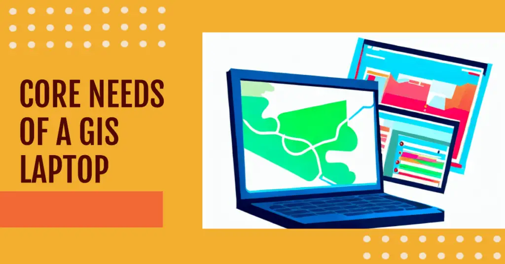
The Core Needs of a GIS Laptop
In today’s rapidly evolving digital world, Geographic Information Systems (GIS) have assumed a paramount role in mapping, spatial analysis, and data visualization.
As GIS professionals and enthusiasts dive deeper into intricate data sets and 3D visualizations, the quintessential tool to empower their endeavors is, indisputably, a high-performing laptop. Let’s shed light on The Core Needs of a GIS Laptop.
The beating heart of any laptop tailored for GIS tasks is its processor. GIS software often requires a potent CPU to manage multiple operations, from simple mapping to complex spatial analyses.
Simultaneously, the RAM (Random Access Memory) can’t be overlooked. A minimum of 16GB RAM, preferably 32GB for extensive projects, ensures seamless multitasking and fluid data manipulation.
Equally vital is the graphics card. While mainstream laptops might flaunt gaming prowess, a GIS-centric laptop needs a professional-grade GPU. This ensures that the real-time rendering of large geospatial datasets, including intricate 3D models, isn’t hindered by lag or stutter.
Moreover, the significance of storage cannot be overstated. Gone are the days of juggling external hard drives. A robust SSD (Solid-State Drive), with a capacity of at least 512GB ensures that data retrieval and saving are swift. Furthermore, opting for 1TB or more is a prudent investment for those with voluminous datasets.
Lastly, while somewhat overshadowed by the hardware above Titans, the display holds a non-negotiable spot among The Core Needs of a GIS Laptop. A high-resolution screen and accurate color reproduction render geospatial visuals full of splendor.
In conclusion, GIS professionals mustn’t simply settle for a generic laptop. The nuanced requirements of their field demand a machine tailored to their needs. Recognizing The Core Needs of a GIS Laptop is the first step towards maximizing productivity and achieving unparalleled precision in geospatial endeavors.
Review of The Best Laptops For GIS Work
1. ASUS ROG Strix G16 – Best For Students
In the realm of cutting-edge technology, the ASUS ROG Strix G16 emerges as an unparalleled contender, poised to revolutionize the experience of GIS students. With its unwavering commitment to power and innovation, this gaming laptop effortlessly metamorphoses into an academic tool par excellence.
Geographic Information Systems (GIS), a multidisciplinary field that demands computational prowess and graphical finesse, finds its perfect companion in the ASUS ROG Strix G16.
The laptop’s formidable Intel Core i7-13650HX processor is a computational titan, effortlessly navigating complex geospatial algorithms while minimizing lag, thus rendering seamless cartographic renderings.
The laptop’s expansive 16-inch 16:10 FHD display with a blazing 165Hz refresh rate defies conventions, offering GIS students an unadulterated canvas to visualize intricate maps and spatial data. The GeForce RTX 4060, an epitome of graphical brilliance, amplifies this visual journey, transforming mundane visuals into a melange of vibrant geo visualizations.
Memory, the cornerstone of productivity, is elevated to a crescendo with 16GB DDR5 RAM. The intricate dance between memory and processor orchestrates a symphony of multitasking prowess, ensuring swift shifts between GIS software and resource-intensive applications.
Storage metamorphoses into an art form with a 512GB PCIe SSD, providing ample space for intricate spatial datasets while accelerating data retrieval rapidly. Coupled with the avant-garde Wi-Fi 6E, data exchange becomes a seamless spectacle, vital for a generation that thrives on interconnectedness.
The ASUS ROG Strix G16, pre-installed with Windows 11, aligns with the aspirations of GIS students, providing an intuitive interface that bridges the chasm between creativity and execution.
In the dynamic universe of GIS, where innovation is the currency, the ASUS ROG Strix G16 emerges as the ultimate arbiter, seamlessly fusing computational might with visual artistry. For GIS students, this laptop isn’t just a tool; it’s an extension of their geospatial dreams.
Pros:-
Powerhouse Performance: The ASUS ROG Strix G16 boasts an impressive Intel Core i7-13650HX processor, delivering exceptional computational power that GIS students require for processing complex geospatial algorithms.
Stunning Visuals: With a generous 16-inch 16:10 FHD display and a blazing 165Hz refresh rate, this laptop offers students an immersive platform to visualize intricate maps and geospatial data with unprecedented clarity.
Graphics Excellence: The GeForce RTX 4060 graphics card elevates visual experiences, transforming ordinary geo visualizations into vibrant, detailed masterpieces, allowing students to analyze spatial data precisely.
Ample Memory: Equipped with 16GB DDR5 RAM, the laptop facilitates multitasking and seamless transitions between GIS software and other resource-intensive applications, enhancing overall productivity.
Swift Data Access: The 512GB PCIe SSD storage provides ample space for spatial datasets and ensures rapid data retrieval, enabling students to work efficiently without storage bottlenecks.
Cutting-edge Connectivity: Wi-Fi 6E guarantees seamless data exchange and connectivity, fostering collaborative work environments and efficient data sharing among peers.
Windows 11 Pre-installed: The laptop has the latest Windows 11 operating system, offering an intuitive interface and enhancing user experience with improved productivity features.
Cons:-
Portability Trade-off: The robust performance components of the ASUS ROG Strix G16 contribute to its relatively larger and heavier form factor, making it less portable compared to ultrabooks or lightweight laptops.
Battery Life: The high-performance hardware, especially the powerful processor and graphics card, may lead to relatively shorter battery life when performing resource-intensive tasks, requiring frequent charging during extended work sessions.
Price Point: The advanced features and specifications come at a cost, making the ASUS ROG Strix G16 a premium investment, potentially exceeding the budget of some GIS students.
Overkill for Basic Tasks: While the laptop’s power and capabilities are perfect for GIS tasks and demanding applications, it might be overkill for students who only require basic computing for coursework or general use.
Limited Customizability: As a pre-built gaming laptop, the ASUS ROG Strix G16 might offer limited hardware upgrades or customization options compared to building a custom PC for specific GIS needs.
In conclusion, the ASUS ROG Strix G16 is an exceptional laptop for GIS students, offering powerful performance, stunning visuals, and cutting-edge features. However, prospective buyers should weigh the advantages against the limitations and consider their requirements and budget before deciding.
Check Price on Amazon2. MSI Raider GE78 HX 13VI-079US – Best For Professionals
In the realm of Geographic Information Systems (GIS), where precision meets innovation, the MSI Raider GE78 HX 13VI-079US emerges as a formidable contender among the best laptops for GIS work for professionals.
With a symphony of advanced features and cutting-edge technology, this laptop transforms intricate spatial data into actionable insights for the discerning GIS practitioner.
At its core, the Intel Core i9-13980HX processor stands as a beacon of computational prowess. It’s a technological maestro that orchestrates complex geospatial calculations, allowing professionals to dissect and analyze intricate datasets efficiently and accurately.
The laptop’s expansive 17.3″ QHD+ display, harmonized with an astonishing 240Hz refresh rate, isn’t just a canvas; it’s a portal to the GIS world. Visualizing geospatial data takes on a new dimension as every contour and layer is unveiled with stunning clarity. The laptop becomes a powerhouse with the RTX 4090 graphics, enabling professionals to craft immersive geo visualizations that transcend the ordinary.
In the realm of multitasking, the 32GB DDR5 RAM reigns supreme. It seamlessly juggles GIS applications, analytical tools, and resource-demanding software, ensuring a seamless workflow where productivity knows no bounds.
Storage evolves into an art form with the inclusion of a spacious 2TB NVMe SSD. This monumental storage capacity accommodates vast spatial datasets and guarantees rapid data access, enhancing efficiency during critical analysis and decision-making processes.
Connectivity becomes a conduit for collaboration with Thunderbolt 4 and USB-Type C ports. Professionals can seamlessly exchange data and insights with peers and external devices, fostering a networked ecosystem of GIS innovation.
Crowning this technological marvel includes Windows 11 Pro, pre-installed to elevate user experience. Its intuitive interface and enhanced productivity features align perfectly with the needs of GIS professionals.
In the grand tapestry of GIS endeavors, the MSI Raider GE78 HX 13VI-079US stands tall as an embodiment of excellence. It’s not just a laptop; it’s a partner that empowers GIS professionals to unravel the intricacies of our world through data-driven insights.
Pros:-
Outstanding Performance: The MSI Raider GE78 HX is powered by the formidable Intel Core i9-13980HX processor, delivering unparalleled processing power for complex GIS calculations and analyses.
Immersive Visuals: The laptop’s expansive 17.3″ QHD+ display with a striking 240Hz refresh rate offers GIS professionals a visually immersive experience, enabling them to analyze spatial data with exceptional clarity.
Graphics Excellence: Equipped with the RTX 4090 graphics card, the laptop enhances geo visualizations, turning data into stunning visual representations that aid in deeper spatial understanding.
Ample Memory: With 32GB DDR5 RAM, multitasking becomes effortless, allowing professionals to switch between GIS applications and resource-intensive software seamlessly.
Spacious Storage: Including a generous 2TB NVMe SSD ensures that GIS professionals have ample storage for their extensive spatial datasets while benefitting from fast data access.
Enhanced Connectivity: Featuring Thunderbolt 4 and USB-Type C ports, the laptop facilitates seamless data exchange and collaboration among peers and external devices, promoting a connected GIS ecosystem.
Windows 11 Pro: The laptop comes pre-installed with Windows 11 Pro, offering an intuitive interface and productivity enhancements that align with the needs of GIS professionals.
Cons:-
Portability Trade-off: The laptop’s robust performance comes with a larger form factor, making it less portable for professionals on the go.
Battery Life: The powerful hardware components, especially the high-performance processor and graphics card, might lead to relatively shorter battery life during resource-intensive GIS tasks.
Premium Price: The advanced features and cutting-edge specifications of the MSI Raider GE78 HX contribute to a higher price point, which might be a consideration for professionals on a budget.
Weight: Due to its powerful hardware and large screen size, the laptop could be heavier than other options, potentially affecting its ease of portability.
Overkill for Basic Tasks: For professionals whose GIS work involves basic tasks and smaller datasets, the laptop’s powerful features might be excessive and not fully utilized.
Limited Customizability: As a pre-built laptop, the MSI Raider GE78 HX may offer limited options for hardware customization compared to building a custom PC tailored to specific GIS needs.
In conclusion, the MSI Raider GE78 HX 13VI-079US is an exceptional choice for GIS professionals seeking unparalleled performance and advanced features. While it offers impressive capabilities, potential buyers should consider their specific requirements, budget, and willingness to trade off some portability for the sake of power.
Check Price on Amazon3. SAMSUNG Galaxy Book2 Pro
In the realm of Geographic Information Systems (GIS), the pursuit of excellence is paramount, and the SAMSUNG Galaxy Book2 Pro emerges as a beacon of innovation, establishing itself as one of the best laptops for GIS enthusiasts. This laptop is a testament to the seamless fusion of cutting-edge technology and the intricate demands of spatial analysis.
The heart of this technological marvel lies in its 12th Gen Intel Core Processor, a computational powerhouse that propels GIS practitioners through complex calculations with unparalleled efficiency. Navigating intricate spatial algorithms becomes a breeze, allowing professionals to delve into geospatial insights without lag.
GIS professionals thrive on multitasking, and the 16GB of memory orchestrates this orchestration of tasks with finesse. This enables seamless transitions between GIS software, analytical tools, and resource-intensive applications, fostering a fluid workflow that enhances productivity.
Visual interpretation gains new dimensions through the laptop’s 15.6″ display, a canvas that brings GIS data to life. This is complemented by its Evo Certified status, promising visual clarity and vibrancy that elevates understanding of intricate geospatial patterns.
In the world of GIS, mobility is often as vital as performance. The Galaxy Book2 Pro bridges this gap elegantly with its lightweight design, allowing professionals to take their GIS insights on the go, ensuring that critical decisions are never tethered to a desk.
Storage limitations cease with the 512GB capacity, offering ample room for storing extensive spatial datasets. Rapid access to data, a cornerstone of effective GIS work, is facilitated, allowing professionals to explore and analyze information promptly.
Modern GIS work thrives on collaboration, and this laptop is equipped with features that bolster connectivity. Whether sharing insights through advanced ports or seamlessly collaborating through virtual environments, the Galaxy Book2 Pro caters to the evolving landscape of GIS interaction.
In spatial exploration, the SAMSUNG Galaxy Book2 Pro is a remarkable contender, redefining what it means to be the best laptop for GIS work. For GIS enthusiasts, it’s not just a laptop; it’s a conduit to uncovering the intricate tapestry of our world through data-driven insights.
Pros:-
Powerful Performance: The SAMSUNG Galaxy Book2 Pro is equipped with a 12th Gen Intel Core Processor, ensuring seamless execution of complex GIS calculations and analysis, boosting productivity.
Enhanced Multitasking: With 16GB of memory, the laptop effortlessly handles multitasking, enabling GIS professionals to work concurrently with multiple software tools and applications.
Vivid Visuals: The 15.6″ display, Evo Certified for excellence, provides vibrant and clear visuals, enhancing the interpretation of geospatial data and maps.
Portability: The laptop’s lightweight design facilitates mobility, allowing GIS practitioners to work from different locations without compromising performance.
Ample Storage: The 512GB storage capacity provides ample room for storing extensive spatial datasets, ensuring quick access to critical information during GIS analyses.
Modern Connectivity: Equipped with advanced ports and connectivity options, the laptop supports seamless data exchange, collaboration, and integration into modern GIS workflows.
Innovative Design: The laptop’s design seamlessly marries sleek aesthetics with practicality, making it visually appealing while catering to GIS professionals’ demands.
Cons:-
Limited Graphics Power: The laptop’s graphics capabilities might not be suitable for highly demanding 3D geospatial visualizations and simulations.
Screen Size Preference: Some GIS professionals might prefer larger screens for in-depth analysis, and the 15.6″ display might not fulfill this preference for all users.
Battery Life: Depending on the intensity of GIS tasks, the laptop’s battery life might be relatively shorter, requiring users to have access to power sources during extended work sessions.
Price Point: The advanced features and performance come at a cost, and the Galaxy Book2 Pro might be on the higher end of the price spectrum for some GIS professionals.
Limited Customization: As a pre-built laptop, customization options for hardware upgrades might be limited compared to building a custom system tailored to specific GIS needs.
The SAMSUNG Galaxy Book2 Pro presents a compelling package for GIS professionals, with powerful performance, portability, and advanced features. While it offers numerous advantages, potential buyers should consider their specific GIS requirements, budget constraints, and preferences before deciding.
Check Price on Amazon4. Acer Predator Helios 300
In the dynamic realm of Geographic Information Systems (GIS), the Acer 2023 Predator Helios 300 stands as a triumphant fusion of power and precision, earning its place as the epitome of the best laptop for ArcGIS Pro. This cutting-edge laptop transcends boundaries, revolutionizing the experience of GIS professionals who demand excellence.
The laptop’s Intel Core i7-12700H 14-Core processor is a symphony of computational brilliance, orchestrating complex geospatial calculations with finesse. The ArcGIS Pro environment becomes a canvas where professionals can craft intricate spatial analyses and simulations with unmatched efficiency.
Visual revelation unfolds on the laptop’s 15.6” 2K QHD 240Hz Display, a window into a world of spatial insights. This display isn’t just a screen; it’s a portal that unveils the intricacies of maps, data, and visualizations in breathtaking clarity. Integrating GeForce RTX 3070 Ti graphics ushers in an era of unparalleled geovisualization, where GIS professionals can delve into the depths of spatial intricacies.
Memory, an enabler of multitasking, finds its zenith with 32GB DDR5 RAM. This orchestration of memory empowers GIS professionals to traverse effortlessly between ArcGIS Pro tasks, other software, and resource-intensive applications.
Storage metamorphoses into an art form with the colossal 2TB PCIe SSD, a sanctuary for voluminous spatial datasets. Rapid data retrieval becomes second nature, ensuring GIS practitioners can navigate through data layers with seamless speed.
The laptop’s prowess extends beyond its hardware. Thunderbolt 4 and RJ-45 ports accentuate its connectivity, fostering an environment where data exchange, collaboration, and networking thrive.
The Acer 2023 Predator Helios 300, a true harbinger of GIS innovation, elevates ArcGIS Pro to new heights. It’s not merely a laptop; it’s a catalyst that propels GIS professionals into a world of unparalleled spatial exploration.
Pros:-
Formidable Performance: The Acer 2023 Predator Helios 300 boasts an impressive Intel Core i7-12700H 14-Core processor, providing exceptional computational power for complex ArcGIS Pro calculations and analyses.
Vivid Visual Experience: The laptop’s 15.6” 2K QHD 240Hz Display offers a stunning visual canvas, enhancing the interpretation of spatial data and geovisualizations within the ArcGIS Pro environment.
Graphics Excellence: Integrating the GeForce RTX 3070 Ti graphics card elevates geovisualization, allowing GIS professionals to delve into intricate spatial patterns and insights with unmatched clarity.
Ample Memory: With 32GB DDR5 RAM, multitasking becomes effortless, enabling seamless transitions between ArcGIS Pro tasks, analytical tools, and resource-intensive applications.
Vast Storage Capacity: Including a spacious 2TB PCIe SSD provides ample space for storing extensive ArcGIS datasets, ensuring quick access to critical information during analyses and decision-making.
Advanced Connectivity: Featuring Thunderbolt 4 and RJ-45 ports, the laptop facilitates seamless data exchange, networking, and collaboration among GIS professionals, enhancing productivity and collaboration.
Future-Ready: With advanced hardware components, the laptop is well-prepared to handle evolving ArcGIS Pro requirements and software updates.
Cons:-
Weight and Portability: The laptop’s powerful hardware may contribute to a slightly heavier form factor, which could impact portability for professionals frequently on the move.
Battery Life: Due to the high-performance components, the laptop’s battery life may be relatively shorter during resource-intensive ArcGIS Pro tasks, requiring access to power sources.
Price Point: The advanced features and specifications of the Acer Predator Helios 300 could position it in a higher price range, potentially exceeding the budget of some GIS professionals.
Graphics Overkill: For professionals primarily using ArcGIS Pro for 2D mapping and basic analysis, the robust graphics capabilities of the laptop might be excessive and not fully utilized.
Limited Customization: As a pre-built laptop, customization options for hardware upgrades might be limited compared to building a custom system tailored to specific GIS needs.
In conclusion, the Acer 2023 Predator Helios 300 presents a compelling option for GIS professionals seeking powerful performance and advanced features within the ArcGIS Pro environment. While it offers numerous advantages, potential buyers should consider their specific GIS requirements, budget constraints, and preferences before deciding.
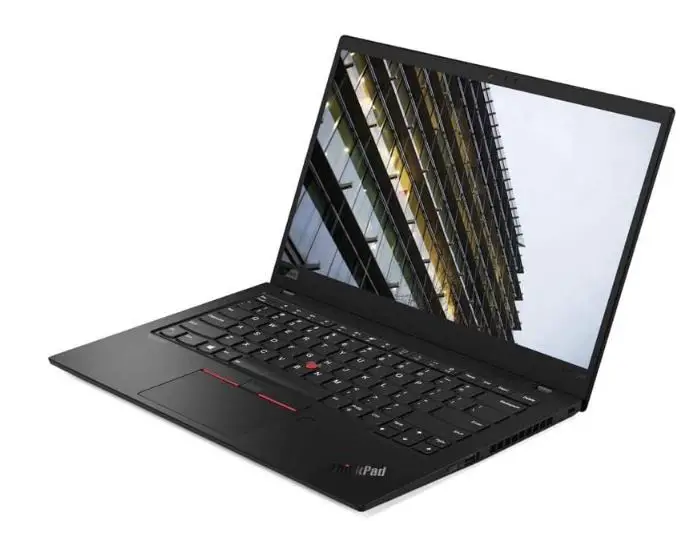
Check Price on Amazon5. Lenovo ThinkPad X1 Carbon Gen 9
In the intricate realm of Geographic Information Systems (GIS), the Lenovo ThinkPad X1 Carbon Gen 9 emerges as a triumphant companion, recognized for its excellence as the best laptop for GIS enthusiasts. This laptop is more than a device; it’s an embodiment of precision and performance, tailored to meet the demands of modern spatial analysis.
The laptop’s Intel Core i7-1165G7 processor is a computational marvel, orchestrating complex geospatial calculations with finesse. GIS professionals can navigate through intricate spatial algorithms and simulations, ensuring every layer of information is unveiled with remarkable speed.
The 14.0″ FHD IPS 400 nits display is a window into the spatial universe, where maps and data come to life with exceptional clarity. Visual insights are elevated to new heights as GIS practitioners dissect spatial patterns with precision and clarity, further enhanced by the UHD Graphics capabilities.
Memory, the linchpin of multitasking, is optimized with 16GB RAM. This ensures seamless transitions between GIS software, analytical tools, and resource-intensive applications, bolstering productivity and facilitating efficient workflow management.
Storing vast spatial datasets becomes seamless with the 2TB PCIe SSD. Rapid data access transforms data exploration into an efficient process, enabling GIS enthusiasts to delve into analyses without storage bottlenecks.
The laptop’s operating system choice, whether Windows 10 Pro 64 or the futuristic Windows 11, aligns with GIS professionals’ preferences, offering an intuitive interface for seamless spatial exploration.
This package includes the MTC 32GB USB Drive, a testament to Lenovo’s commitment to enhancing the GIS journey by providing additional storage for critical data backup and mobility.
The Lenovo ThinkPad X1 Carbon Gen 9, with its impeccable blend of innovation and practicality, reaffirms its position as the best laptop for GIS work. It empowers GIS professionals to unravel intricate geospatial insights, turning data into actionable intelligence with unparalleled finesse.
Pros:-
Impressive Performance: The Lenovo ThinkPad X1 Carbon Gen 9 is powered by the Intel Core i7-1165G7 processor, delivering powerful computing performance crucial for GIS tasks.
Vibrant Display: The 14.0″ FHD IPS 400 nits display offers exceptional clarity, ensuring GIS professionals can accurately analyze maps and spatial data.
Enhanced Visuals: Including UHD Graphics elevates geovisualization, allowing for a detailed exploration of spatial patterns and insights.
Efficient Multitasking: With 16GB RAM, the laptop enables smooth multitasking, facilitating seamless transitions between GIS software and resource-intensive applications.
Ample Storage: The 2TB PCIe SSD provides ample space for storing vast spatial datasets, ensuring quick data access and efficient analysis.
Choice of Operating System: The laptop offers a choice between Windows 10 Pro 64 and Windows 11, catering to GIS professionals’ preferences and compatibility needs.
Additional Storage: Including the MTC 32GB USB Drive provides extra storage for critical data backup and mobility, enhancing overall productivity.
Cons:-
Limited Graphics Power: While the laptop features UHD Graphics, it might not be suitable for highly demanding 3D geospatial visualizations and simulations.
Battery Life: Depending on the intensity of GIS tasks, the laptop’s battery life might be relatively shorter during resource-intensive work, requiring access to power sources.
Price: The advanced features and specifications of the ThinkPad X1 Carbon Gen 9 could position it at a higher price point, which might exceed the budget of some GIS professionals.
Graphics Limitations: For professionals requiring heavy graphics processing, the laptop’s integrated graphics might not provide the level of performance needed.
Limited Customization: As a pre-built laptop, customization options for hardware upgrades might be limited compared to building a custom system tailored to specific GIS needs.
In conclusion, the Lenovo ThinkPad X1 Carbon Gen 9 presents a compelling option for GIS professionals seeking performance, portability, and efficient multitasking. While it offers numerous advantages, potential buyers should consider their specific GIS requirements, budget constraints, and preferences before deciding.
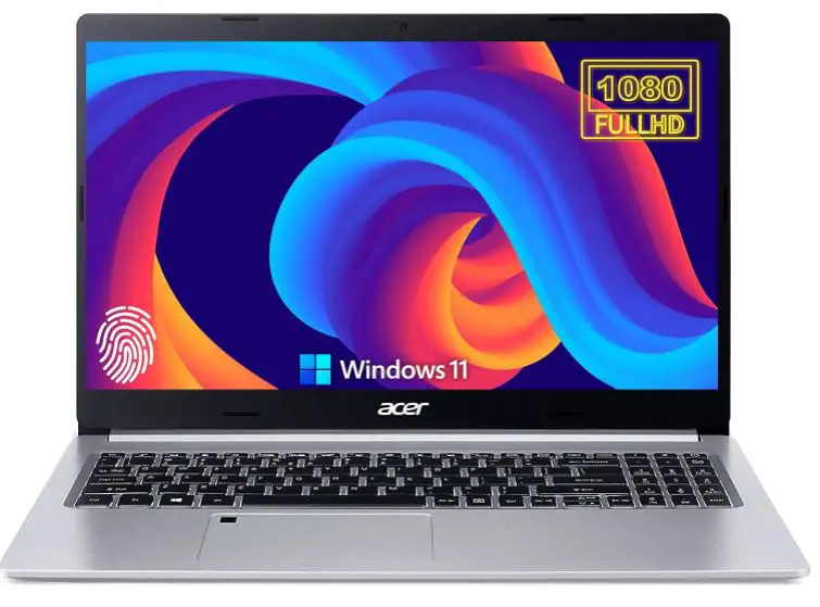
Check Price on Amazon6. Acer Newest Aspire 5 – Best Under Budget
In the intricate landscape of Geographic Information Systems (GIS), the Acer Newest Aspire 5 emerges as a champion, seamlessly bridging performance and affordability to claim its spot as the best laptop for GIS under budget. This laptop redefines expectations, offering GIS enthusiasts an exceptional toolkit without breaking the bank.
The laptop’s brilliance is evident in its AMD Ryzen 4-Core Processor, a testament to efficient computing power. This processor synergizes seamlessly with the demands of GIS calculations, propelling spatial analyses with precision.
The 15.6″ Full HD Display visually showcases GIS data, allowing professionals to dive into maps and geovisualizations. This visual journey is further enhanced by the Backlit Keyboard, an ally for late-night work sessions when spatial insights beckon.
Memory is the heartbeat of multitasking, and the 20GB RAM facilitates this orchestration with elegance. This abundance of memory ensures that GIS professionals can traverse ArcGIS and analytical tools with fluidity, enhancing overall efficiency.
Storage, often a problem, finds a resolute solution with the 1TB SSD Storage. This generous capacity offers ample space for extensive spatial datasets, while the rapid data access ensures that GIS analyses proceed without hindrance.
Connectivity is pivotal in modern GIS workflows, and this laptop excels with its range of ports, including HDMI, Ethernet Port, and Type-C. These ports foster a seamless environment for data exchange and collaboration.
As a reflection of technological advancement, the Windows 11 S operating system lends a modern interface to this laptop, elevating user experience and productivity in the GIS realm.
In the budget-conscious journey of GIS exploration, the Acer Newest Aspire 5 is an emblem of excellence. It’s a laptop that accommodates spatial dreams and nurtures them, proving that the best laptop for GIS under budget is well within reach.
Pros:-
Cost-Effective Performance: The Acer Newest Aspire 5 balances performance and affordability, making it an excellent choice for GIS enthusiasts on a budget.
Efficient Processor: Including an AMD Ryzen 4-Core Processor ensures smooth GIS calculations and analyses, even under budget constraints.
Clear Visuals: The 15.6″ Full HD Display offers clear visuals, enhancing the interpretation of GIS maps and spatial data.
Enhanced Multitasking: With 20GB RAM, the laptop supports efficient multitasking, allowing seamless transitions between GIS software and analytical tools.
Ample Storage: The 1TB SSD Storage provides enough space for storing extensive spatial datasets, with rapid data access for smooth GIS analyses.
Diverse Connectivity: Featuring ports like HDMI, Ethernet Port, and Type-C, the laptop supports various connectivity options, facilitating data exchange and collaboration.
Modern Operating System: The presence of Windows 11 S ensures a modern interface and enhanced user experience, aligning with the demands of contemporary GIS work.
Cons:-
Limited Graphics Power: The laptop’s integrated graphics might not be suitable for highly demanding 3D geospatial visualizations and simulations.
Battery Life: Depending on the intensity of GIS tasks, the laptop’s battery life might be relatively shorter during resource-intensive work, requiring access to power sources.
Budget Build: While cost-effective, the laptop’s build might not match the premium quality of more expensive options.
Limited Customization: Due to budget constraints, customization options for hardware upgrades might be limited compared to pricier alternatives.
Weight and Portability: The laptop’s design might not be as lightweight and portable as some higher-end models, potentially affecting mobility.
In summary, the Acer Newest Aspire 5 is a budget-friendly option that provides respectable performance for GIS tasks. While it has its limitations, it offers a valuable solution for GIS enthusiasts seeking a capable laptop without overspending. As with any purchase, prospective buyers should consider their GIS needs and budget constraints before deciding.
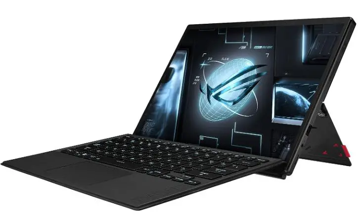
Check Price on Amazon7. ASUS ROG Flow Z13
In Geographic Information Systems (GIS), where precision meets innovation, the ASUS ROG Flow Z13 emerges as a transformative force, asserting its position as the best laptop for ArcGIS Pro. This technological marvel redefines how GIS professionals interact with spatial data, ushering in a new era of spatial analysis.
At its core, the Intel Core i9-13900H processor stands as a beacon of computational brilliance. Its remarkable power is akin to a conductor orchestrating intricate geospatial calculations, allowing ArcGIS Pro users to navigate through complex spatial analyses with remarkable speed and efficiency.
The laptop’s 13.4” Nebula Display 16:10 QHD 165Hz is a canvas of spatial exploration. It’s not just a screen; it’s a window into the world of spatial data, where maps and visualizations spring to life with exceptional clarity and vibrancy.
Geovisualization ascends to new heights with the GeForce RTX 4050 graphics. This graphics card unlocks the potential for stunning 3D visualizations, allowing GIS professionals to immerse themselves in intricate spatial patterns, turning data into captivating stories.
Memory takes center stage with 16GB LPDDR5 RAM, providing ample resources for multitasking within the ArcGIS Pro environment. Shifting between spatial analyses, mapping, and data manipulation becomes a fluid dance that enhances productivity.
Storage attains a new dimension with the 1TB PCIe SSD, offering ample room for vast spatial datasets and rapid data access that expedites the analytical process, minimizing downtime and maximizing insights.
Connectivity in the modern GIS landscape is essential, and the Wi-Fi 6E ensures seamless data exchange and collaboration. This laptop thrives as a hub for interdisciplinary spatial exploration and insight sharing.
The ASUS ROG Flow Z13, with its fusion of technology and innovation, rises as the embodiment of excellence in ArcGIS Pro. It’s a laptop that empowers GIS professionals to decipher intricate spatial nuances, turning data into a transformative force for decision-making.
Pros:-
Powerhouse Performance: The ASUS ROG Flow Z13 is driven by the formidable Intel Core i9-13900H processor, providing unmatched computational power for complex ArcGIS Pro calculations and analyses.
Immersive Display: The laptop’s 13.4” Nebula Display 16:10 QHD 165Hz offers an immersive canvas for GIS professionals to visualize and explore spatial data with exceptional clarity and vibrancy.
Cutting-Edge Graphics: Including the GeForce RTX 4050 graphics card enhances geovisualization, allowing for intricate 3D spatial representations and captivating visualizations.
Efficient Multitasking: Equipped with 16GB LPDDR5 RAM, the laptop ensures smooth multitasking, enabling seamless transitions between ArcGIS Pro tasks, analytical tools, and other applications.
Swift Data Access: The 1TB PCIe SSD provides ample storage for extensive spatial datasets and rapid data access, contributing to efficient GIS analyses and decision-making.
Advanced Connectivity: With Wi-Fi 6E, the laptop facilitates seamless data exchange, collaboration, and interaction within the modern GIS ecosystem.
Portable Innovation: The laptop’s design combines innovation with portability, allowing GIS professionals to carry cutting-edge technology, enhancing spatial analysis on the go.
Cons:-
Higher Price Point: The advanced features and specifications of the ASUS ROG Flow Z13 might position it at a higher price range, which could exceed the budget of some GIS professionals.
Battery Life: Due to the powerful hardware components, such as the high-performance processor and graphics card, the laptop’s battery life might be relatively shorter during intensive ArcGIS Pro tasks.
Weight: The laptop’s advanced hardware might contribute to a slightly heavier form factor, impacting its portability for professionals on the move.
Overkill for Basic Tasks: For professionals whose GIS work involves basic tasks and smaller datasets, the laptop’s powerful features might be excessive and not fully utilized.
Limited Customization: As a pre-built laptop, customization options for hardware upgrades might be limited compared to building a custom system tailored to specific GIS needs.
In conclusion, the ASUS ROG Flow Z13 presents a compelling choice for GIS professionals seeking cutting-edge performance and advanced features within the ArcGIS Pro environment. While it offers numerous advantages, potential buyers should consider their specific GIS requirements, budget constraints, and preferences before deciding.
Check Price on Amazon8. Microsoft Surface Pro 9
In the intricate realm of Geographic Information Systems (GIS), where precision meets innovation, the Microsoft Surface Pro 9 emerges as a quintessential tool, recognized as the best laptop for GIS professionals.
This 2-in-1 marvel redefines how GIS practitioners interact with spatial data, ushering in a new era of seamless analysis and visualization.
At the heart of this technological prowess lies the Intel 12th Gen i7 Fast Processor, a testament to computational brilliance. This processor operates as a conductor orchestrating complex geospatial calculations, allowing GIS professionals to navigate through intricate spatial analyses with remarkable speed and precision.
This device’s dual nature shines with its 13″ 2-in-1 Tablet and laptop design. Whether leveraging the touch screen for fluid map interaction or deploying the laptop mode for data manipulation, the Surface Pro 9 adapts to the multifaceted demands of GIS professionals.
Memory becomes an asset for multitasking, and the 16GB RAM seamlessly handles the orchestration. Transitions between ArcGIS tasks, data visualization, and analytical software are as smooth as a well-choreographed GIS workflow.
Storage receives a boost with 1TB Storage, accommodating vast spatial datasets. The Surface Pro 9 ensures quick data access, a cornerstone for efficient GIS analyses that demand immediate insights.
Visual experiences are enriched by the 13″ display, providing a canvas for GIS data that’s as vivid as the landscapes it represents. The slim and lightweight design ensures that this canvas accompanies GIS professionals wherever spatial insights beckon.
The synergy of software and hardware culminates with Windows 11, an operating system that aligns seamlessly with the demands of modern GIS professionals. This ensures a familiar interface for efficient spatial exploration.
The Microsoft Surface Pro 9 is an emblem of excellence in the journey of GIS mastery. It’s a device that fosters GIS dreams and propels them, proving that the best laptop for GIS professionals is embodied in a versatile, innovative, and precision-driven companion.

Pros:-
Versatile 2-in-1 Design: The Microsoft Surface Pro 9 offers a seamless transition between tablet and laptop modes, catering to diverse GIS tasks, from interactive map exploration to data analysis.
Powerful Processor: Including the Intel 12th Gen i7 Fast Processor ensures robust computing performance, enabling GIS professionals to tackle complex calculations and analyses.
Ample Memory: With 16GB RAM, the laptop supports efficient multitasking, allowing smooth transitions between GIS software, analytical tools, and other applications.
Generous Storage: The 1TB Storage capacity provides ample room for extensive spatial datasets, ensuring quick data access during GIS analyses and decision-making.
Vivid Display: The 13″ display presents GIS data with clarity and precision, enhancing the interpretation of maps and geovisualizations.
Portability: The slim and lightweight design of the Surface Pro 9 ensures easy mobility, enabling GIS professionals to work from various locations without compromise.
Modern Operating System: The integration of Windows 11 provides an up-to-date interface, aligning with the demands of contemporary GIS work and enhancing user experience.
Cons:-
Keyboard and Accessories: While the Surface Pro 9 offers a versatile design, some users might find the detachable keyboard and accessories less comfortable for prolonged typing than traditional laptops.
Limited Graphics Power: The integrated graphics might not be suitable for highly demanding 3D geospatial visualizations and simulations.
Battery Life: Depending on the intensity of GIS tasks, the laptop’s battery life might be relatively shorter during resource-intensive work, requiring access to power sources.
Price: The advanced features and specifications of the Surface Pro 9 could position it at a higher price point, which might exceed the budget of some GIS professionals.
Limited Customization: As a pre-built device, customization options for hardware upgrades might be limited compared to building a custom system tailored to specific GIS needs.
In conclusion, the Microsoft Surface Pro 9 offers a compelling option for GIS professionals seeking a versatile, powerful, and portable device for their spatial analysis and visualization tasks. While it presents numerous advantages, potential buyers should consider their specific GIS requirements, budget constraints, and preferences before deciding.
Check Price on Amazon9. HP Flagship 17 Laptop
In the intricate landscape of Geographic Information Systems (GIS), where data converges with technology, the HP Flagship 17 Laptop emerges as a prime choice, embodying excellence as one of the best laptops for GIS students.
This technological marvel redefines the learning experience, offering students an exceptional toolkit to explore the world of spatial analysis.
At the heart of this laptop lies the impressive 13th Intel 10-Core i5-1335U processor, a computational powerhouse that orchestrates geospatial calculations with finesse. This processor is akin to a mentor for aspiring GIS students, guiding them through the complexities of spatial data analysis.
The laptop’s 17.3″ IPS FHD(1920 x 1080) Display is a window to the GIS world. It’s not just a screen; it’s a canvas where maps, layers, and data visualizations come to life in vibrant clarity, enhancing students’ ability to interpret spatial patterns.
Equipped with Iris Xe Graphics, the laptop elevates geovisualization for GIS students, allowing them to create captivating representations of spatial data. This graphics capability transforms GIS assignments into engaging visual narratives.
Memory, an enabler of multitasking, finds its zenith with the 36GB RAM. This abundance of memory empowers students to transition seamlessly between ArcGIS tasks, web research, and resource-intensive applications, enhancing their productivity.
Storing voluminous datasets becomes a seamless endeavor with the 1TB SSD. Quick data access ensures that GIS students can focus on analysis rather than waiting for data retrieval.
The laptop’s Backlit Keyboard enhances productivity during late-night study sessions, and the inclusion of Bluetooth 5.3 showcases the laptop’s commitment to modern connectivity.
Operated by Windows 11 Home, the laptop’s software ecosystem aligns seamlessly with the learning journey of GIS students, providing an interface that’s intuitive and conducive to exploration.
In the voyage of GIS education, the HP Flagship 17 Laptop stands as a beacon of technological support. It’s a laptop that equips GIS students with the tools they need and propels them to navigate the spatial landscape with confidence and curiosity.
Pros:-
Robust Performance: The HP Flagship 17 Laptop features the impressive 13th Intel 10-Core i5-1335U processor, providing strong computational power for GIS tasks and analyses.
Generous Display: The 17.3″ IPS FHD(1920 x 1080) Display offers ample screen real estate, enhancing the visualization of GIS maps and spatial data.
Enhanced Geovisualization: With Iris Xe Graphics, the laptop allows GIS students to create captivating visualizations, making their spatial analyses more engaging and insightful.
Ample Memory: The 36GB RAM ensures smooth multitasking, enabling seamless transitions between GIS software, web research, and other applications.
Ample Storage: The 1TB SSD provides ample space for storing extensive GIS datasets, ensuring quick access to critical information during analyses and studies.
Modern Connectivity: Including Bluetooth 5.3 showcases the laptop’s commitment to modern connectivity standards, facilitating seamless data exchange and interaction.
Backlit Keyboard: The backlit keyboard enhances productivity during late-night study sessions, contributing to an efficient learning experience.
Cons:-
Graphics Limitations: While suitable for basic geovisualization, the integrated Iris Xe Graphics might not be sufficient for advanced 3D spatial visualization and simulations.
Battery Life: Depending on the intensity of GIS tasks and usage, the laptop’s battery life might be relatively shorter, requiring access to power sources.
Weight and Portability: The laptop’s larger screen size might contribute to a slightly heavier form factor, potentially impacting portability for students on the move.
Limited Customization: As a pre-built laptop, customization options for hardware upgrades might be limited compared to building a custom system tailored to specific GIS needs.
Price Point: While offering impressive specifications, the laptop’s advanced features might position it in a higher price range, which could exceed the budget of some GIS students.
In summary, the HP Flagship 17 Laptop offers a compelling option for GIS students seeking a balance between performance and affordability. While it presents numerous advantages, potential buyers should consider their specific GIS study needs, budget constraints, and preferences before deciding.
Check Price on AmazonOS and Software Compatibility For Popular GIS Software
Software proficiency and versatility are paramount in the world of Geographical Information Systems (GIS). However, the linchpin for seamless GIS operations often revolves around OS and Software Compatibility For Popular GIS Software’s.
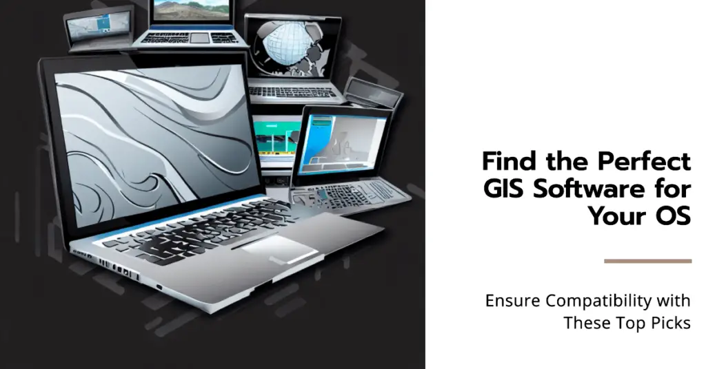
For any professional, understanding these compatibilities can mean the difference between efficient project execution and hours of troubleshooting.
To start, it’s imperative to understand the symbiotic relationship between an operating system (OS) and the GIS software. GIS applications are designed to run optimally on certain OS platforms as a key fits a specific lock. This optimization is not merely incidental; it’s a painstakingly crafted synergy that ensures the software functions at its zenith.
The preeminent GIS software, like Esri’s ArcGIS, Quantum GIS (QGIS), and GRASS GIS, have profoundly evolved. They’ve expanded in terms of functionalities and been refined to be compatible with multiple operating systems. Let’s delve deeper into their compatibility spectrum.
ArcGIS, a luminary in the GIS domain, primarily finds its home on Windows platforms. Historically, this software’s intricate tie to the Windows ecosystem has been its strength and limitation.
While Windows users reap the rewards of this close-knit integration, macOS and Linux enthusiasts often seek alternative solutions or emulators to bridge the compatibility chasm.
In stark contrast, QGIS champions flexibility. This open-source GIS titan offers versions tailored to Windows, macOS, Linux, and Android. The mélange of platforms it supports is a testament to its commitment to universal accessibility and functionality.
GRASS GIS, another open-source stalwart, follows suit with QGIS. Designed with a penchant for adaptability, it is available for Windows, macOS, Linux, and more. The software’s architecture underscores the quintessence of OS diversity, ensuring that GIS professionals are unshackled from the constraints of platform specificity.
It’s not just about the OS, though. The intricacies of OS and Software Compatibility For Popular GIS Software also extend to peripheral software components. Database systems, middleware, and certain drivers can greatly influence GIS software performance.
For instance, the compatibility of PostGIS, a spatial database extender for PostgreSQL, with your chosen GIS software could be the linchpin for intricate spatial analyses.
Furthermore, the paradigm of cloud computing and virtual machines has introduced another layer to this compatibility matrix. GIS software must now be compatible with traditional desktop OS, cloud-based systems, and virtual environments. This ensures that GIS professionals can harness the power of scalable cloud resources and virtualized platforms.
In conclusion, the dance between GIS software and operating systems is intricate and intimate. The ever-expanding landscape of OS and Software Compatibility For Popular GIS Software warrants continuous exploration by GIS aficionados. It’s not just about selecting the right software; it’s about ensuring that your entire digital environment is harmoniously aligned for peak GIS performance.
As technology continues its relentless march forward, one can anticipate even more exciting developments, further enhancing the symbiosis between GIS software and its supporting platforms.
The Importance of Regular Backups, Especially with GIS Projects
Data preservation is the lifeblood of any tech-centric operation. The significance of this cannot be overstated in the realm of Geographical Information Systems (GIS), where colossal amounts of spatial data are processed and analyzed.

Imagine the painstaking work of mapping a city’s infrastructure, only to lose all the data due to an unexpected system crash. It’s akin to building a sandcastle at the water’s edge and watching it disappear. Hence, “The importance of regular backups, especially with GIS projects” resonates profoundly with every GIS professional.
GIS projects, by nature, involve multitudinous layers of information, each meticulously interwoven to offer a holistic spatial perspective. The symbiosis of cartographic details, statistical data, and spatial analyses further augments the data’s complexity.
Losing such a composite construct could lead to financial implications and a significant setback in project timelines and strategic implementations.
Regular backups ensure that all the digital toil invested in such projects isn’t in vain. These backups serve as checkpoints, creating periodic safety nets, ensuring that a GIS professional can revert to the most recent, uncorrupted version of their project in the event of unforeseen calamities like data corruption, hardware failures, or even human errors.
Considering External Monitors for Dual-Screen Setups at a Workstation
Screen real estate is a prized commodity in the sprawling expanse of the digital workspace. As professionals grapple with multiple software interfaces, data visualization panels, and analytical tools, the limitations of a single screen become painfully evident. This brings us to “Considering external monitors for dual-screen setups at a workstation.”

The advent of dual-screen setups has been revolutionary for GIS enthusiasts. With two screens, a user can simultaneously view the map on one screen while running statistical analyses or data manipulations on the other. Such an arrangement enhances productivity and significantly reduces the toggling fatigue synonymous with single-screen operations.
Moreover, an external monitor offers higher resolution and better color accuracy, which is crucial for GIS applications where visual fidelity can make or break an analysis.
The panoramic expanse offered by dual screens allows for a more immersive data interpretation experience, paving the way for better decision-making and more detailed analyses.
The Potential Benefit of Extended Warranties or Insurance for Heavy Users
Technology, for all its marvels, is not impervious to wear and tear. Intensive users, especially those in the GIS domain, can attest to the rigors their hardware is subjected to.
Frequent data crunching, relentless usage, and even the occasional accidental coffee spill can take a toll. In these scenarios, “The potential benefit of extended warranties or insurance for heavy users” becomes not just relevant but imperative.
An extended warranty acts as a cushion, a financial safety net, ensuring that it can be repaired or replaced without incurring a hefty cost if the hardware falters before its time. Such assurances are invaluable for GIS professionals, whose work often hinges on their technological tools.
Then there’s the avenue of insurance, a broader spectrum of protection. While warranties typically cover manufacturing defects or hardware failures, insurance can cover a gamut of mishaps – accidental damage to theft.
For heavy users who’ve tailored their devices with bespoke software and tools, losing a device isn’t just about the hardware; it’s about the time and resources invested in customizing it. Insurance offers a semblance of protection against such losses.
In summation, the digital edifice of GIS is supported by three pivotal pillars – data preservation through regular backups, expansive visualization via dual-screen setups, and hardware longevity ensured by extended warranties and insurance.
Each facet is crucial in ensuring that GIS professionals can operate optimally unhindered by technological frailties or limitations. As the world becomes more data-centric, ensuring these foundations are robust will be paramount for continued success in geographical information and analysis.
📗FAQ’s
What kind of computer do I need for GIS?
Select a computer with a robust configuration that can handle complex geospatial tasks. A multi-core processor with high clock speed enhances processing, while a dedicated graphics card accelerates visualization.
How much RAM do I need for GIS?
For optimal performance, a minimum of 16GB RAM is recommended. Larger datasets and advanced analyses may require more memory.
Do you need a dedicated graphics card for GIS?
A dedicated graphics card is essential, especially when working with 3D visualization and large spatial datasets. Look for GPUs from NVIDIA, like the RTX series, for improved performance.
What is the best graphics card for ArcGIS?
The NVIDIA RTX 30 series offers excellent performance for ArcGIS, ensuring smooth rendering and manipulation of intricate maps.
Is 16GB RAM enough for ArcGIS?
Yes, 16GB RAM is typically sufficient for moderate ArcGIS usage, but 32GB or more is preferable for handling larger projects.
Does GIS need coding?
Basic coding skills in languages like Python can enhance GIS capabilities, allowing you to automate tasks and develop custom tools.
What is the best processor for GIS?
A high-end multi-core processor like an Intel Core i7 or AMD Ryzen 9 is recommended for GIS tasks, as it speeds up data processing.
Do I need Python for GIS?
Python is highly beneficial for GIS, enabling you to create scripts and automate processes, improving efficiency.
Is 8GB RAM enough for ArcGIS?
While 8GB RAM can run ArcGIS, performance may be limited, especially with larger projects. Opt for more RAM for smoother operation.
Is CPU or GPU more important for GIS?
Both are important, but a powerful CPU aids data processing, while a GPU enhances visualization and 3D rendering.
What are the laptop requirements for Qgis?
A laptop with a fast multi-core processor, 16GB or more RAM, and a dedicated GPU is ideal for QGIS tasks.
Does ArcGIS use CPU or GPU?
ArcGIS relies on CPU and GPU, with CPU handling computations and GPU enhancing graphics and rendering.
What computer specs do I need for ArcGIS?
ArcGIS performs best with a high-performance CPU, dedicated GPU, 16GB+ RAM, and ample storage for large datasets.
Is ArcGIS better than Qgis?
Both are powerful, but ArcGIS offers comprehensive features for professional use, while QGIS is open-source and more suitable for smaller projects.
Which is better RTX or GTX for architecture?
The RTX series offers better performance for architecture due to advanced ray tracing and rendering capabilities.
Is 8GB RAM enough for ArcGIS Pro?
8GB RAM can run ArcGIS Pro, but consider 16GB or more for optimal performance.
How much RAM is best for AutoCAD?
For seamless AutoCAD usage, 32GB RAM is recommended, particularly for handling complex designs.
Is ArcGIS Pro free?
No, ArcGIS Pro is not free. It requires a subscription or license purchase.
Does GIS use Python or R?
GIS primarily uses Python for scripting, automation, and analysis, while R is less common but can be used for statistical analysis.
What language is used in GIS?
The main languages used in GIS are Python, SQL, and occasionally R.
Is Python or R better for GIS?
Python is more widely used in GIS due to its versatility and extensive libraries tailored for geospatial tasks.
Which country is good in GIS?
Countries like the Netherlands, Canada, and the United States are known for their advanced use of GIS in various sectors.
Why is GIS difficult?
GIS can be challenging due to its technical aspects, data integration complexities, and the need to understand spatial relationships.
Why is GIS better than CAD?
GIS is advantageous over CAD as it incorporates spatial analysis, allowing for more profound insights beyond mere design.
Does GIS use C++?
While not as common, C++ can be used in GIS development for creating high-performance applications.
Is ArcGIS Python free?
ArcGIS includes a version of Python called ArcPy that comes with the software, allowing users to script and automate tasks.
Does Qgis use Python?
Yes, QGIS supports Python scripting, enabling users to extend its functionality and automate processes.
How much RAM does Qgis use?
QGIS memory usage varies with project size, but having 16GB or more RAM ensures smoother operation.
What is software in GIS?
GIS software facilitates geographic data collection, analysis, interpretation, and visualization.
Can ArcGIS run on Mac?
Recent versions of ArcGIS support macOS, allowing Mac users to utilize GIS capabilities.
What size monitor is best for GIS?
A larger monitor, such as a 27-inch or larger with high resolution, benefits GIS tasks by providing ample screen space for maps and data.
Is ArcGIS compatible with Windows 11?
Yes, ArcGIS is compatible with Windows 11, ensuring continued functionality on the new operating system.
What is hardware in GIS?
Hardware in GIS refers to the physical components like computers, graphics cards, and memory that enable geospatial tasks.
Is it difficult to learn QGIS?
Learning QGIS can be initially challenging, but its user-friendly interface and abundant resources make the process smoother.
Can I install QGIS and ArcGIS on the same computer?
Yes, you can install both QGIS and ArcGIS on the same computer without conflicts, allowing you to use both platforms.
Is it hard to use QGIS?
QGIS’s intuitive interface makes it relatively easy to use, especially with some practice and learning.
Is GIS RAM intensive?
Yes, GIS tasks, especially handling large datasets and complex analyses, can be RAM-intensive for smoother performance.
Can my computer run GIS?
Check your computer’s specifications against software requirements to determine if it can effectively run GIS applications.
Which is better ArcGIS desktop or ArcGIS Pro?
ArcGIS Pro offers a more modern interface and improved performance than ArcGIS Desktop.
Is AMD good for ArcGIS?
Yes, AMD processors offer competitive performance for ArcGIS tasks alongside Intel counterparts.
What is the price of ArcGIS software?
ArcGIS pricing varies based on the package and licensing options, with different pricing for personal, educational, and enterprise use.
Can ArcGIS run on 4gb RAM?
While it’s possible to run ArcGIS with 4GB RAM, 8GB or more is recommended for smoother operation.
Do companies use QGIS?
Many companies use QGIS due to its cost-effectiveness and open-source nature, especially for smaller projects and organizations.
Conclusion
We’ve established that in the intricate and demanding realm of GIS, a subpar laptop can become a significant roadblock, leading to inefficiencies and frustrations.
Remember, every moment you spend waiting for a map to render or dealing with unexpected crashes could have been spent analyzing data, drawing insights, or presenting compelling visuals to stakeholders.
Fortunately, by choosing from our list of the “Best Laptops For GIS,” you’re arming yourself with a robust tool designed to handle the most demanding GIS tasks easily.
As technology continues to evolve, so should your tools. Make an informed decision, invest wisely, and ensure that your GIS projects run seamlessly, delivering accurate and impactful results every time.


