


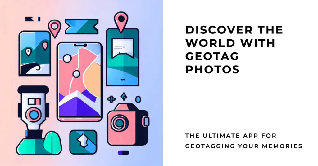
In the age of smartphones and digital photography, capturing memories is as easy as a simple tap on your screen. But how often do you look back at a photo and struggle to remember where it was taken?🤷♂️
Whether it’s a beautiful landscape from a recent trip or a candid moment at a local event, the lack of location context can leave you feeling disconnected from your memories.
This problem grows as our photo libraries expand. Thousands of photos are stored, often without any reference to where they were captured. It becomes a chaotic mess, making it difficult to organize memories or share the complete story behind your pictures.
Imagine finding that perfect shot from your last vacation but being unable to recall or show where it was taken. Frustrating, isn’t it?
Enter Geotag Photos Apps, the technological marvel to rescue your photographic memories. These apps automatically tag your photos with precise location information, turning your digital gallery into a well-organized map of memories. From planning your photo journeys to sharing location-specific albums with friends, Geotag Photos Apps add a new dimension to photography.
In this article, we’ll explore the best Geotag Photos Apps on the market, breaking down their features, benefits, and how they can reinvigorate your connection to your pictures.
Why Use Geotag Photos Apps?
In the ever-evolving landscape of digital photography, the geotag photos apps have emerged as indispensable tools for amateur enthusiasts and seasoned professionals.
These applications seamlessly fuse the realm of geography with the artistry of photography, offering many benefits that transcend the conventional bounds of image documentation.
Geotagging, the process of embedding geographical information into digital photographs, is the cornerstone of these applications. As the modern world becomes increasingly interconnected, integrating location data imparts a new dimension to visual storytelling. Geotag photos apps empower users to capture a moment in time and etch it onto a specific place on the globe.
One might ask, why is geotagging relevant? The answer lies in the profound narratives it weaves. Imagine exploring a photograph and being transported to the exact coordinates where it was taken—the bustling streets of Marrakech or the serene shores of Bora Bora.
This immersive experience transcends the limitations of traditional captions, fostering a deep connection between the observer and the observed.
Beyond its artistic allure, geotagging bears practical implications. Travel enthusiasts can meticulously catalog their globetrotting escapades, creating virtual maps of their adventures. Moreover, photographers seeking to recreate specific lighting conditions or compositions can revisit precise locations, elevating their craft to new heights.
As technology strides forward, geotag photos apps remain at the vanguard. With intuitive interfaces and real-time tracking capabilities, they encapsulate innovation that mirrors our dynamic world.
So, whether you’re a wanderlust-driven explorer, an architectural aficionado, or a memory-weaving artist, consider embracing the power of geotagging—where pixels and coordinates converge to craft a richer, more evocative visual narrative.
Best Geotag Photos Apps – Precision and Context
1. GPS Map Camera
In modern photography, precision and context intertwine seamlessly with innovation. Enter the GPS Map Camera app, an ingenious solution that is the pinnacle among geotag photos apps for Android and iPhone platforms.
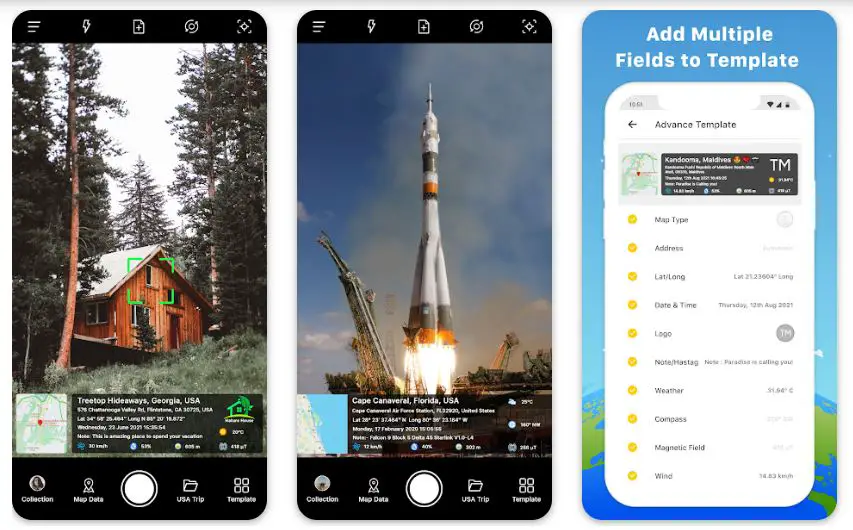
The GPS Map Camera app reigns supreme when it comes to preserving moments with unparalleled accuracy. This remarkable tool marries the art of photography with advanced GPS technology, effortlessly embedding intricate geotagging data onto each captured frame. This unique synergy allows users to transcend the boundaries of mere images, creating an immersive experience where time and location converge.
The app’s interface exudes elegance and simplicity, providing an intuitive platform for users to capture, annotate, and share their visual chronicles. With just a few taps, every photograph gains a virtual anchor on the map, granting viewers the privilege to journey through space and time.
What truly sets the GPS Map Camera app apart is its meticulous attention to detail. It offers an array of options to fine-tune geotagging precision, catering to the needs of photographers who demand nothing short of perfection. Whether you’re an avid traveler, a nature enthusiast, or a professional lens artist, this app empowers you to craft narratives that unfold across the global canvas.
Available on both Google Play Store and the Apple App Store, the GPS Map Camera app embraces a wide audience, ensuring that the benefits of accurate geotagging are accessible to all. Its compatibility with various devices underscores its commitment to inclusivity and excellence.
In a world where pixels are as precious as memories, the GPS Map Camera app embodies innovation and functionality. It redefines how we perceive and share our visual tales, elevating photography from a simple hobby to an immersive journey that encapsulates time and place.
Experience the fusion of technology and creativity; experience the GPS Map Camera app—your gateway to a richer, more connected world of imagery.
Pros:-
Pinpoint Accuracy: The GPS Map Camera app excels in accuracy, ensuring that geotagging data is seamlessly embedded into each photograph. This precision is crucial for travelers, explorers, and professionals who rely on location-specific documentation.
User-Friendly Interface: Navigating the app is a breeze, even for those less tech-savvy. Its intuitive design allows users to capture images effortlessly, add location data, and share their visual stories with minimal effort.
Enhanced Storytelling: Geotagging transforms photos into captivating narratives. The app empowers users to tell richer stories by providing a geographical context that immerses viewers in the experience.
Customization Options: The app caters to diverse preferences by offering customizable settings for geotagging accuracy. Users can fine-tune the level of detail to suit their specific needs.
Cross-Platform Availability: The app ensures compatibility with a broad spectrum of devices for Android and iPhone users, promoting inclusivity and accessibility.
Cons:-
Battery Consumption: Geotagging relies on GPS functionality, which can drain device batteries faster than usual. Extended usage while geotagging may necessitate frequent charging.
Privacy Concerns: While geotagging adds a layer of context, it also reveals information about the user’s location. Care should be taken when sharing photos online, as malicious parties can exploit this data.
Limited Offline Functionality: The app’s effectiveness relies on a stable internet connection to accurately retrieve location data. In areas with poor connectivity, geotagging might be less precise.
Storage Usage: Geotagged photos can occupy more storage space due to the embedded location data. This might necessitate regular device clean-ups or the use of cloud storage solutions.
Learning Curve: Despite its user-friendly design, some individuals might require a brief adjustment period to grasp the app’s features and settings fully.
In conclusion, the GPS Map Camera app is a formidable player in geotagging, offering advantages that cater to a diverse audience. Its precision, user-friendly interface, and potential for immersive storytelling make it an appealing choice.
However, users should be mindful of potential battery drain, privacy implications, and the need for a reliable internet connection. As with any technological tool, weighing the pros and cons against personal requirements will determine whether the GPS Map Camera app aligns with individual needs and preferences.
Download The App From Google Play Store
Download The App From Apple App Store
2. Timestamp Camera
In the ever-evolving landscape of mobile photography, Timestamp Camera emerges as a beacon of innovation, offering a remarkable blend of precision and context that elevates it to the ranks of the best geotag photos apps available for Android and iPhone platforms.
Timestamp Camera is not just a photography app; it’s a time-traveling companion that intricately weaves geographical data into every snapshot. This dynamic integration of geotagging technology empowers users to encapsulate moments in pixels and precise coordinates on the global canvas.
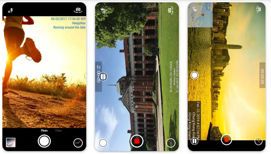
The app’s prowess lies in its seamless fusion of time and location and its user-centric design. With an intuitive interface that caters to novices and experts alike, capturing, annotating, and sharing photos becomes an effortless endeavor. Each photo becomes a testament to your journey, equipped with the power to transport viewers to the spot where the image was taken.
Timestamp Camera raises the bar with its versatility, offering advanced options for tailoring geotagging accuracy to your preference. Whether you’re an avid traveler, a nature enthusiast seeking to document ecosystems, or a professional photographer aiming to enrich your portfolio, the app provides an unparalleled avenue for creative expression.
Available on both the Google Play Store and Apple App Store, Timestamp Camera bridges the technological gap, ensuring its benefits are accessible to a wide spectrum of users. Its compatibility across diverse devices underscores its commitment to democratizing the advantages of precise geotagging.
However, like any technological marvel, there are considerations to ponder. Using GPS for geotagging might impact battery life, warranting prudent usage. Additionally, the app’s reliance on location data necessitates mindful sharing to safeguard personal privacy.
In the universe of mobile apps, Timestamp Camera emerges as a transformative ally that enhances your visual chronicles. It doesn’t merely capture moments; it imprints them onto the tapestry of time and space.
Embrace the power of the Timestamp Camera and unlock a realm where each photo is a chapter in a global narrative, each click a journey that transcends the boundaries of the present.
In the bustling realm of mobile photography, Timestamp Camera has etched its name as a prominent player, offering a tapestry of advantages and considerations that users should be aware of when seeking an impeccable geotagging experience on Android and iPhone platforms.
Pros:-
Precision Geotagging: Timestamp Camera excels in accuracy, embedding intricate geographical data seamlessly into every image captured. This precision is paramount for globetrotters, adventurers, and professionals relying on precise location documentation.
Intuitive Interface: Navigating the app is a breeze, even for those unacquainted with complex technology. Its user-friendly design simplifies capturing, annotating, and sharing photos, turning every snapshot into a geography-anchored visual tale.
Enhanced Visual Storytelling: Geotagging is more than a feature; it’s a storytelling tool. Timestamp Camera empowers users to weave enriched narratives by providing a geographical context that immerses viewers into the moment captured.
Customization at Its Best: The app acknowledges diverse user needs by offering customizable settings for geotagging accuracy. Users can calibrate the level of detail according to their specific requirements.
Cross-Platform Availability: Accessible on both Android and iPhone devices, Timestamp Camera accommodates a wide spectrum of users, bridging the technological gap and making geotagging accessible to a broad audience.
Cons:-
Battery Drain: Using GPS for geotagging can lead to increased battery consumption. Extended usage while geotagging might necessitate more frequent recharging.
Privacy Concerns: While geotagging enhances context, it also divulges location information. Users must exercise caution when sharing images online, considering potential privacy implications.
Internet Dependency: Precise geotagging relies on a stable internet connection for accurate location data retrieval. In regions with limited connectivity, the app’s efficiency might be compromised.
Storage Considerations: Geotagged photos can consume more storage space due to embedded location data. Users may need to manage storage or employ cloud solutions to accommodate this.
Learning Curve: Despite its user-friendly design, some users might require a brief acclimation period to explore the app’s features and settings.
Timestamp Camera emerges as a sophisticated solution for geotagging enthusiasts, delivering a comprehensive suite of advantages. Its precision, user-friendly interface, and potential for augmented storytelling make it a compelling choice.
However, prospective users should be mindful of battery usage, privacy concerns, and the need for a stable internet connection. As with any technological tool, a thoughtful evaluation of pros and cons aligned with personal requirements will determine whether Timestamp Camera resonates as the ultimate geotagging companion.
Download The App From Google Play Store
Download The App From Apple App Store
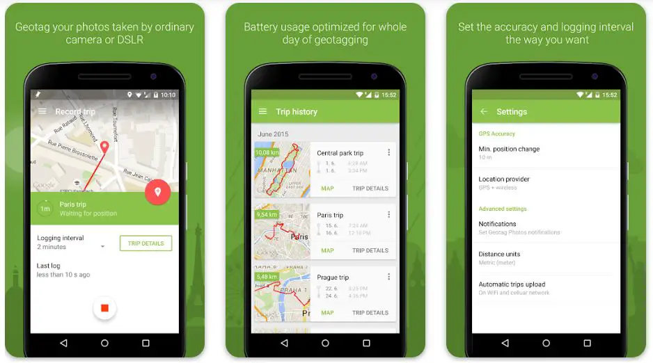
3. Geotag Photos Pro 2
In the bustling realm of photography, where pixels freeze moments in time, the Geotag Photos Pro 2 app is the epitome of excellence. Available on both Android and iOS platforms, including iPad and even Apple Watch, this app doesn’t just tag locations; it crafts intricate stories through the marriage of imagery and geographical data.
Geotag Photos Pro 2 makes every photo a chapter in a global narrative. Its precision goes beyond mere tagging, imprinting each image with a virtual anchor to its precise location. The app thrives on its ability to encapsulate the essence of a place, making memories not just visual but spatially tangible.
The interface, an elegant symphony of design and functionality, invites users to partake in a journey. Capturing, annotating, and sharing photos are seamlessly integrated into an experience beyond the ordinary. Every tap becomes an act of artistic documentation.
One of the defining features of Geotag Photos Pro 2 is its versatility. It accommodates the wanderlust-driven explorer’s needs and the meticulous photographer seeking technical brilliance. The app harmonizes user preferences with a nuanced balance of customizable settings.
As the sun sets on one’s photographic pursuits, the app’s compatibility with multiple devices keeps the light of innovation shining. From smartphones to tablets, and even wrist-bound companions like the Apple Watch, the reach of Geotag Photos Pro 2 spans dimensions.
Geotag Photos Pro 2 stands as a masterpiece in the grand tapestry of geotagging. It’s more than an app; it’s a canvas where pixels and coordinates converge, painting vivid tales of time and place. Whether capturing mountain vistas or urban symphonies, this app transforms your photography into an immersive odyssey of memories and locations.
In location tagging, Geotag Photos Pro 2 shines as a beacon of innovation, offering a range of advantages and considerations that discerning users should weigh when seeking to elevate their photography experience.
Pros:-
Unparalleled Precision: Geotag Photos Pro 2 excels in accuracy, seamlessly embedding detailed geographical data into each photograph. This meticulous precision is invaluable for travelers, adventurers, and professionals relying on precise location documentation.
Intuitive Interface: The app boasts a user-friendly design that simplifies capturing, annotating, and sharing photos. It transforms every snapshot into a captivating journey by weaving geographical context into the visual tale.
Immersive Storytelling: Beyond mere tagging, the app transforms photos into narratives. Adding geographical coordinates enriches stories, making viewers feel as if they’re present at the exact moment and place of capture.
Customization Options: Geotag Photos Pro 2 provides a spectrum of customizable settings for geotagging accuracy, catering to the needs of a diverse user base. This flexibility ensures the app aligns with individual preferences.
Versatility Across Devices: Available not only for Android and iOS devices but also compatible with iPad and Apple Watch, the app extends its reach across various platforms, ensuring accessibility and usability.
Cons:-
Battery Consumption: The app’s reliance on GPS functionality for precise geotagging can lead to higher battery usage. Users may need to balance usage to avoid draining their devices quickly.
Privacy Concerns: While geotagging adds a layer of context, it also exposes location information. Users must exercise caution when sharing images online to safeguard their privacy.
Internet Dependency: The app’s accuracy depends on a stable internet connection to fetch precise location data. This reliance might compromise functionality in areas with limited connectivity.
Storage Requirements: Geotagged photos may consume more storage space due to the added location data. Users may need to manage their storage or opt for additional solutions to accommodate this.
Learning Curve: Despite its user-friendly design, some users might require a brief adjustment period to comprehensively explore the app’s features.
In conclusion, Geotag Photos Pro 2 is a testament to precision and innovation in location tagging. Its precision, user-friendly interface, and capacity for immersive storytelling set it apart.
However, users should be mindful of battery usage, privacy implications, and the need for a stable internet connection. With the balance of pros and cons in mind, users can determine if Geotag Photos Pro 2 aligns with their geotagging aspirations and photographic endeavors.
Download The App From Google Play Store
Download The App From Apple App Store
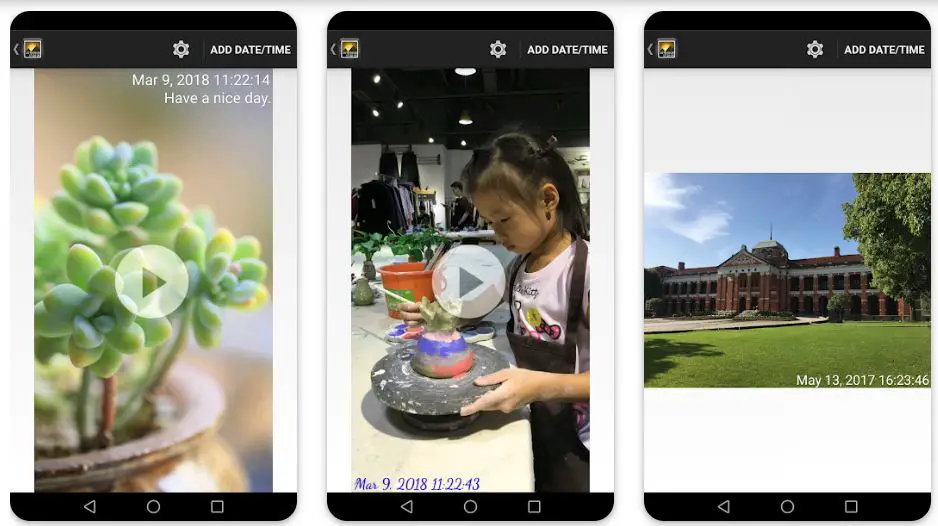
4. Timestamp Camera – Date Stamp
In the ever-evolving landscape of visual documentation, the Timestamp Camera app by Artify Inc stands as a beacon of innovation, offering a seamless solution to geotag multiple photos.
Accessible on Android and iOS platforms, including iPhone and iPad, this app transcends traditional photography by adding a layer of geographical context to each frame.

The Timestamp Camera app by Artify Inc isn’t merely a tool; it’s a time-stamping maestro that empowers users to chronicle their journeys through intricate geotagging. Capturing multiple photos is transformed into an immersive experience where each image is imprinted with a virtual coordinate on the global map.
What sets this app apart is its capacity to maintain precision even when dealing with multiple photos. Whether you’re documenting a travel escapade or a special event, the app’s design ensures that each image retains its unique timestamp and geographical marker, creating a seamless tapestry of moments.
From a user perspective, Timestamp Camera by Artify Inc is a true gem. Its interface strikes a harmonious balance between intuitive navigation and sophisticated functionality.
It bridges the gap between visual storytelling and technical accuracy, allowing users to capture and annotate multiple photos easily.
Geotagging isn’t just about location; it’s about adding depth to memories. Timestamp Camera by Artify Inc adds another dimension to this practice by enriching the visual narrative of multiple photos.
Whether you’re a photography enthusiast or professional documenting events, this app transforms each image into a chapter in a global story where time and place converge in remarkable harmony.
In visual documentation, the Timestamp Camera app by Artify Inc offers a range of advantages and considerations when it comes to geotagging multiple photos. Delving into the features and functionalities of this app provides a comprehensive perspective on its utility.
Pros:-
Effortless Geotagging: The Timestamp Camera app by Artify Inc simplifies the process of geotagging multiple photos. It streamlines the task, allowing users to chronicle their visual narratives with geographical context seamlessly.
Precise Chronology: By collaborating with Artify Inc, this app ensures that each image within multiple photos receives an accurate timestamp and geographical marker. This precision maintains the integrity of the story being told.
Seamless User Experience: The app’s design, thoughtfully crafted by Artify Inc, balances user-friendly navigation and intricate functionality. This design philosophy makes geotagging multiple photos accessible to users of varying levels of expertise.
Comprehensive Documentation: Whether you’re documenting travels, events, or creative projects, the Timestamp Camera app by Artify Inc enhances the depth of the narrative within multiple photos. It adds a layer of context that enriches the storytelling process.
Cross-Platform Availability: Available on Android and iOS platforms, including iPhone and iPad, the app extends its reach to a wide array of users, ensuring that the advantages of geotagging multiple photos are accessible to all.
Cons:-
Battery Consumption: As with any app that utilizes device resources, consistently using Timestamp Camera by Artify Inc for geotagging multiple photos might lead to increased battery consumption. Users should consider managing their device’s power usage.
Privacy Considerations: Geotagging multiple photos reveals location details, potentially impacting user privacy. Users must exercise discretion when sharing such images online or with a broader audience.
Storage Implications: While the app focuses on geotagging multiple photos, adding geographical markers might slightly increase storage requirements. Users should manage their device’s storage accordingly.
Learning Curve: Despite its user-friendly design, users might require some time to familiarize themselves with all features, especially when managing geotagging multiple photos.
In conclusion, the Timestamp Camera app by Artify Inc offers a valuable tool for geotagging multiple photos with precision and context. Its ease of use, accurate chronology, and accessibility across platforms underscore its value.
While considering its usage, users should weigh battery consumption, privacy concerns, storage requirements, and the learning curve. Through collaboration with Artify Inc, this app enhances the narrative of multiple photos, crafting a visual journey where moments are anchored in both time and place.
Download The App From Google Play Store
Download The App From Apple App Store
5. Timestamp photo and video
In the world of visual storytelling, the Timestamp Photo and Video app emerges as a powerful tool that goes beyond conventional photography. With a presence on Android and iOS platforms, including iPad, this app transforms simple images and videos into chronicles of moments, etching time onto each frame.
Timestamp Photo and Video isn’t just about capturing visuals and encapsulating time. Crafted to perfection, this app empowers users to imprint accurate timestamps onto their photographs and videos, infusing them with historical context and significance.
One of the remarkable aspects of Timestamp Photo and Video is its ability to integrate timestamps into both photos and videos seamlessly. Whether a single snapshot or a dynamic video clip, this app ensures that time becomes an inherent part of the visual narrative.
The user experience is where this app truly shines. Navigating the intuitive interface is effortless, and incorporating timestamps doesn’t disrupt the creative process. Timestamp Photo and Video bridges the gap between capturing spontaneous moments and adding a chronological layer.
With Timestamp Photo and Video, users can chronicle their journey, transforming each image and video into a chapter of a larger story. Whether you’re an amateur photographer, a seasoned content creator, or someone seeking to preserve life’s fleeting moments, this app provides a canvas where time becomes an integral brushstroke.
In a world where images and videos capture visuals and emotions, Timestamp Photo and Video ensure that time isn’t merely a concept; it’s a tangible presence in every frame. It’s a tool that captures the essence of moments, offering a unique perspective that adds depth to your visual tales.
The Timestamp Photo and Video app presents a blend of advantages and considerations that users should evaluate when considering its usage. Exploring the features and functionalities of this app provides insight into its potential benefits and limitations.
Pros:-
Time Anchoring: The standout feature of Timestamp Photo and Video is its ability to add accurate timestamps to both photos and videos. This feature empowers users to preserve the exact moment each image or video was captured, enhancing the narrative with temporal context.
Seamless Integration: Whether dealing with single photos or dynamic video clips, this app seamlessly incorporates timestamps without disrupting the creative process. It allows users to chronicle their moments with precision and ease.
Enhanced Storytelling: The incorporation of timestamps adds depth to visual narratives. By offering historical context, Timestamp Photo and Video enrich each image’s and video’s emotional resonance, turning them into a visual journey through time.
User-Friendly Interface: The intuitive interface of Timestamp Photo and Video ensures easy navigation and usage. It caters to both novice users and experienced content creators, making adding timestamps to visuals accessible and efficient.
Diverse Applications: Timestamp Photo and Video cater to many users, from amateur photographers to professional content creators. It’s a versatile tool that adds value to personal memories and professional projects.
Cons:-
Battery Usage: Like many apps, consistent Timestamp Photo and Video usage might lead to increased battery consumption due to device resource utilization. Users should consider managing power usage.
Privacy Concerns: Timestamped photos and videos reveal visual content and time-specific details. Users must exercise caution when sharing such content, considering privacy implications.
Storage Implications: Adding timestamps could slightly increase storage requirements for images and videos. Users should monitor and manage their device’s available storage accordingly.
Learning Curve: While the interface is user-friendly, some users might require a brief adjustment period to explore all the features comprehensively.
In conclusion, Timestamp Photo and Video are valuable tools for adding temporal context to visual content. Its ability to seamlessly integrate timestamps, enhance storytelling, and cater to diverse user needs is commendable.
Users should balance battery consumption, privacy concerns, storage considerations, and the learning curve when considering its usage. Timestamp Photo and Video become a window into the past, a way to preserve the essence of fleeting moments within the framework of time.
Download The App From Google Play Store
Download The App From Apple App Store
6. Timestamp It – Photo Stamper
In visual documentation, Timestamp It – Photo Stamper emerges as a stellar companion for iPhone users seeking to transcend traditional photography. This app redefines how we capture moments by seamlessly integrating accurate timestamps and geotags into each image.
Designed for iPhone users, Timestamp It – Photo Stamper is a testament to geotagging technology innovation. With precision reminiscent of an artisan’s touch, this app imprints every photograph with the moment it was captured and the exact geographical coordinates of its origin.
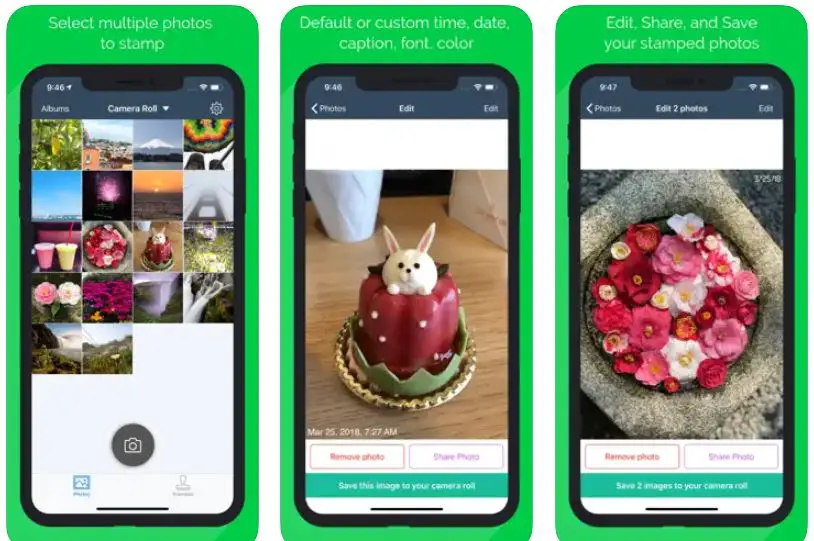
The app’s versatility shines as it caters to various use cases. Whether you’re an avid traveler capturing breathtaking vistas, a nature enthusiast documenting diverse ecosystems, or a professional photographer seeking to enhance your portfolio, Timestamp It – Photo Stamper provides a rich array of features to enrich your visual narratives.
The user experience is a testament to intuitive design. The app’s interface, tailored for iPhones, ensures that adding timestamps and geotags becomes second nature. Capturing moments and augmenting them with contextual information is a seamless endeavor that doesn’t interrupt your creative flow.
One of the app’s standout features is its compatibility across platforms, including iPad and Messages. This forward-thinking approach extends its functionality to various dimensions of your digital life, allowing you to stamp your memories with time and place, no matter the medium.
Timestamp It – Photo Stamper emerges as a brushstroke of innovation in the vibrant tapestry of geotagging apps. It’s not just about capturing images; it’s about preserving memories through time and space.
For iPhone users seeking to elevate their visual storytelling, this app stands as a beacon of creativity and precision, ensuring that every image is a chapter in the grand narrative of your life.
As iPhone users explore the realm of geotagging and visual documentation, the Timestamp It – Photo Stamper app presents various advantages and considerations that merit attention. A closer examination of the app’s features provides valuable insights into its potential benefits and limitations.
Pros:-
Precise Geotagging: The standout feature of Timestamp It – Photo Stamper lies in its ability to integrate accurate timestamps and geotags into each image. This precision gives users an authentic portrayal of the moment and its geographical context.
User-Friendly Interface: The app’s interface, tailored for iPhones, ensures a smooth and intuitive experience. Adding timestamps and geotags becomes effortless, allowing users to enhance their visual narratives seamlessly.
Versatile Applications: From avid travelers to professional photographers, the app caters to diverse users. It’s an invaluable tool for capturing moments with temporal and geographical context.
Cross-Platform Compatibility: The app’s compatibility across various platforms, including iPad and Messages, expands its utility. Users can extend the reach of their stamped memories across different mediums.
Enhanced Storytelling: By collaborating with Timestamp It – Photo Stamper, images transform into narratives that transcend time and place. The addition of timestamps and geotags adds depth to the visual storytelling experience.
Cons:-
Battery Usage: Regular use of the app might lead to increased battery consumption due to the utilization of device resources. Users should consider optimizing their power usage.
Privacy Considerations: Geotags reveal location-specific details that may raise privacy concerns. Users must exercise caution when sharing images online or with a broader audience.
Storage Implications: Adding timestamps and geotags could marginally increase image storage requirements. Users should manage their device’s available storage accordingly.
Learning Curve: While the app’s interface is user-friendly, some users might require a brief adjustment period to explore its full features.
In conclusion, Timestamp It – Photo Stamper is a powerful tool for enhancing visual documentation through geotagging and timestamps. Its accuracy, user-friendly interface, and cross-platform compatibility underscore its value.
Users should balance battery consumption, privacy concerns, storage considerations, and the learning curve when considering its usage. By collaborating with Timestamp It – Photo Stamper, users elevate their visual narratives, ensuring that every image becomes a snapshot of both time and place.
Download The App From Apple App Store
Considerations When Choosing a Geotagging App
In the digital age, where every photo tells a story, integrating location data through geotagging adds a layer of richness to visual narratives. As the demand for geotagging apps continues to rise, it’s crucial to consider several key factors before choosing.
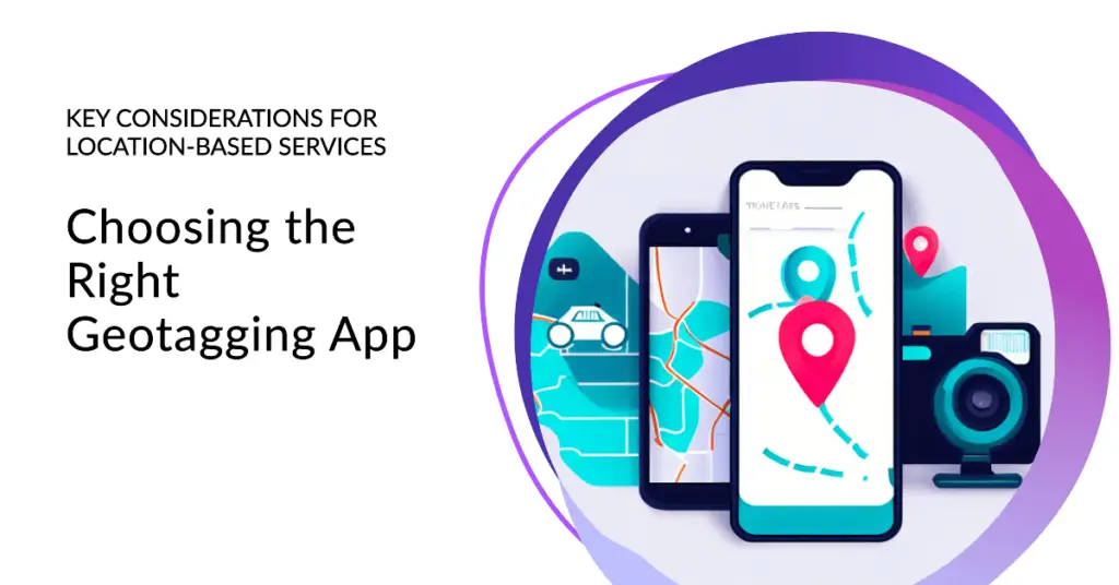
Whether you’re a professional photographer, an avid traveler, or simply an individual seeking to enhance your photo collection, here are essential Considerations When Choosing a Geotagging App that can shape your decision-making process.
1. Precision and Accuracy: The cornerstone of a reliable geotagging app lies in its ability to provide precise and accurate location data. Look for apps that utilize advanced technologies, such as GPS and mapping services, to ensure that the geotags embedded in your photos reflect the actual coordinates of your capture.
2. User-Friendly Interface: A geotagging app should enhance your photography experience, not complicate it. Opt for an app with an intuitive and user-friendly interface that allows for easy tagging of locations without causing confusion or frustration.
3. Compatibility: Consider the platforms you frequently use for photography, whether a smartphone, tablet, or wearable device. Ensure the chosen app is compatible with your devices and operating systems, providing a seamless experience across various mediums.
4. Customization Options: Each photographer’s needs are unique. Look for an app that offers customization options, allowing you to adjust geotag settings to align with your preferences. This can include choosing the level of detail in location data or the format of timestamps.
5. Battery Efficiency: Geotagging often involves utilizing your device’s GPS, which can drain your battery. A well-designed app should balance providing accurate data and conserving battery life.
6. Privacy Controls: Location data can be sensitive information. Ensure that the geotagging app you choose provides privacy controls that allow you to decide when and where to include location data in your photos. This is particularly important when sharing images online.
7. Offline Functionality: Consider situations where you might not have a stable internet connection, such as remote locations or during travels. An app offering offline geotagging capabilities ensures you can capture moments even when disconnected.
8. Integration with Other Apps and Services: If you use other photography or social media apps, consider whether the chosen geotagging app can seamlessly integrate. This can enhance the overall efficiency of your workflow.
9. Reviews and Reputation: Explore user reviews and testimonials before committing to a geotagging app. This can provide insights into real-world experiences and help you gauge the app’s performance, reliability, and overall user satisfaction.
10. Cost and Value: While some geotagging apps are free, others might have a price tag. Evaluate the features offered about the cost to determine whether the app provides value for your specific needs.
In conclusion, geotagging apps offer many options, each catering to unique preferences and requirements. By considering factors such as precision, usability, compatibility, customization, battery efficiency, privacy, offline functionality, integration, reputation, and cost, you can make an informed decision that aligns with your photography goals.
As you explore the array of geotagging apps available, remember that the right choice can transform your photos into captivating visual narratives that capture moments and the essence of place and time.
How To Use Geotagging Apps
In modern photography, the integration of geographical context has become a cornerstone of visual storytelling. Geotagging apps have emerged as a powerful tool to elevate your photography experience by infusing each image with the essence of place and time.
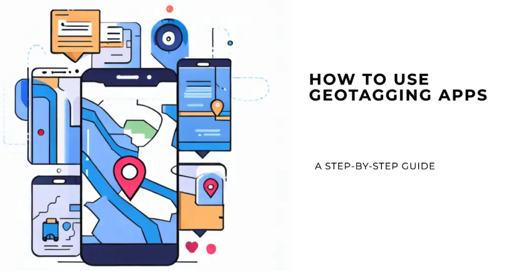
Whether you’re a travel enthusiast, a nature lover, or a professional photographer, understanding How to Use Geotagging Apps can unlock a new dimension of creativity and narrative depth.
1. Choose the Right App:- The first step in mastering geotagging is selecting the right app for your needs. Research various options available for your device’s Android or iOS platform and assess their features, compatibility, and user reviews to find the best fit.
2. Enable Location Services:- Ensure your device’s location services are turned on before geotagging. Geotagging apps rely on GPS and Wi-Fi signals to pinpoint your location accurately, so enabling this feature is essential.
3. Open the App:- Launch the geotagging app on your device. Familiarize yourself with the user interface, navigation options, and settings.
4. Capture or Import Photos:- You can capture new photos using the app’s camera or import existing ones from your gallery. Geotagging apps allow you to add location data to both.
5. Apply Geotags:- Explore the app’s geotagging feature once your photo is selected. A location pin or a map icon usually denotes this. Tap on it to initiate the geotagging process.
6. Choose Location:- The app will prompt you to select or search for the location where the photo was taken. You can enter keywords and addresses or use the map to pinpoint the spot.
7. Review and Confirm:- After selecting the location, the app may preview the geotagged photo and the associated coordinates. Review the details to ensure accuracy before confirming.
8. Customize Additional Details:- Many geotagging apps allow you to customize additional details, such as the level of location accuracy, time stamps, and even notes or descriptions related to the photo.
9. Save or Share:- Save the changes once you’re satisfied with the geotagging information. Your photo is now enriched with location data. You can share it on social media, store it in your gallery, or even print it with the geotag included.
10. Explore the Enhanced Narrative:- Geotagging isn’t just about pinpointing a location but weaving a narrative. When you revisit your geotagged photos, you’re transported back to the exact spot where the image was captured, allowing you to relive the moment with greater depth.
11. Respect Privacy:- While geotagging adds context, consider privacy concerns. Some apps allow you to choose when and where to include geotags, especially when sharing images online.
In conclusion, mastering How to Use Geotagging Apps is a journey that enhances your photography by infusing each image with the spirit of place and time. By choosing the right app, enabling location services, applying geotags, customizing details, and respecting privacy, you transform your photos into captivating narratives that resonate beyond the visual.
Geotagging isn’t just a technical skill; it’s an art that elevates your storytelling capabilities and allows you to share the world as you experience it – one location-enhanced photo at a time.
📗FAQ’s
How can I geotag my photos?
Geotagging involves adding geographical coordinates to your photos, and capturing the exact location where each image was taken. This can be done using specialized apps or software.
How can I geotag my photos for free?
Several apps offer free geotagging features. Look for apps like GPS Map Camera or Timestamp It – Photo Stamper that provide accuracy and affordability.
What is the app that geolocates photos?
GPS Map Camera and Timestamp It – Photo Stamper are examples of apps that geolocate photos, enhancing them with detailed location information.
How do I geotag photos offline?
Some geotagging apps allow you to capture location data without an internet connection. The data is stored and applied when you regain connectivity.
How do I create a geotag location?
In geotagging apps, you can manually enter location details or use GPS to determine the exact coordinates of your photo’s location.
How do I geotag a photo on my phone?
Using a geotagging app like GPS Map Camera, open the photo within the app, and enable location services to add automatically geotags.
Is geotagging accurate?
Geotagging accuracy depends on the app and the device’s GPS. Well-designed apps tend to offer accurate results, capturing your location precisely.
How do I geotag an image in Google Earth?
In Google Earth, right-click on the image’s location, select “Properties,” and then add location coordinates to geotag the image.
How do I geotag photos on my iPhone?
Use a geotagging app like Timestamp It – Photo Stamper. Open the app, import your photo, enable location services, and apply geotags.
What is the new geotagging app?
The landscape is always evolving, but apps like Geotag Photos Pro 2 and Timestamp Camera by Artify Inc offer advanced features for geotagging.
Does geotagging work without the Internet?
Some apps allow you to geotag photos offline, storing location data until you regain connectivity.
Is Geotagging automatic?
In most cases, geotagging requires user initiation, ensuring accuracy and control over location data.
How do I geotag multiple photos?
Apps like Geotag Photos Pro 2 offer batch geotagging capabilities, allowing you to tag multiple photos simultaneously.
What is the difference between GPS and geotagging?
GPS is the technology that determines your location, while geotagging is attaching this location data to your photos.
What is geo tracking?
Geo-tracking involves monitoring and recording the movement of an object or person using GPS technology.
How do I see geotagged photos on a map?
Apps like GPS Map Camera display your geotagged photos on a map interface, showing their exact locations.
What is an example of geotagging?
An example is using a geotagging app to add the precise location coordinates of where you took a photo, enhancing its context.
Are all iPhone photos geotagged?
No, geotagging is optional. You can enable or disable location services for your photos in your iPhone settings.
Is geotagging free?
Many apps offer free geotagging features, but some advanced functionalities might come with a price.
Does GPS work when the phone is off?
No, GPS requires your device to be on to determine your location accurately.
How to use GPS on iPhone?
Enable location services in your iPhone settings to use GPS for various apps, including geotagging.
Go to your device’s settings, find the location services option, and enable it for the apps you want to use for geotagging.
Conclusion
We started with a common dilemma: a collection of photos with no way to remember or convey where they were taken. This problem, as mundane as it might seem, can disconnect us from our treasured memories and rob our images of their full context.
Geotag Photos Apps emerged as the elegant solution to this issue, providing a seamless way to link your images with the places that inspired them. By exploring the best apps available, we’ve uncovered tools that cater to various needs, preferences, and budgets.
It’s time to breathe new life into your photo library and reforge those connections to the places you’ve captured. Whether you’re an avid traveler, a photography enthusiast, or just someone who wants to keep their memories well-organized, Geotag Photos Apps offer a gateway to a richer, more engaging visual experience.
Why leave your memories incomplete when you can augment them with the power of location? Try one of the Geotag Photos Apps today, and let your photos tell the full story.