


No matter whether you’re fixing furniture, or you’re building a new house, angle measurement is one of the most important technical aspects.
Without the right analyses and efficient measurement, it’s impossible to build a sustainable thing. According to physic, angles play a very important part to hold and sustain anything.
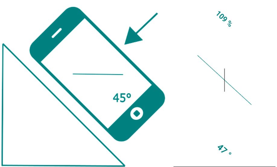
In our daily life, we frequently get in trouble with angle measurement as it’s almost impossible to judge and measure angles with naked eyes. That’s why we use an inclinometer. But what inclinometer really is?
What is Inclinometer?
The inclinometer is a scientific instrument that helps us to analyze and measure angles, surfaces, inclination, etc. very efficiently. With the help of an Inclinometer, we can judge any object and its inclination, and get data in various units, which helps us to make the right decisions.
But nowadays you don’t need a physical inclinometer for measurement. You’ll get various inclinometer apps on the internet and you can make use of them to measure angles and inclinations very easily.
To help you guys with efficient angle measurement, I was searching for the best inclinometer apps and now I’ve got the 9 best inclinometer apps with me which you can make use of.
So, let’s proceed with the list.
Best Inclinometer Apps – Our Top Pick 👌
1. Laser Level & Clinometer
The first name on our list is Laser Level. This app is one of the most popular inclinometer apps. Laser Level has got over 10 million downloads on Play Store and it has managed to maintain a rating of 4.3, which is pretty amazing.
Looking at the number of downloads and users, we can guess how good this app is. The best part is that you can use the Laser Level app for free.
With the help of the Laser Level app, you can measure with laser precision, which is very helpful. On the Laser Level app, you’ll be able to measure vertically, horizontally, or at any angle.
Laser Level is an excellent measurement app with various useful tools and high-quality features. On the Laser Level app, you’ll get the support of a laser pointer, which will be very helpful while measuring.

You’ll also get the support of 3 mode sprit level and clinometer, which will help you to measure vertical angles and horizontal plates. This app is very handy and flexible too, so it would be very helpful for all the users out there.
The innovative laser pointer feature is the biggest highlight of this app. This laser pointer uses built-in sensors and the device’s camera to determine the vertical and horizontal levels and to provide you with the correct measurement.
To make use of the bubble level feature, you have to place your device on any object or surface, and by doing that you can easily measure the angles. By using the clinometer feature, you can determine the angle of inclination.
On the Laser Level app, you can see all the data in various units, like- degree, percentage, rise, etc. With the help of the Laser Level app, you can also calibrate the level of your device, adjust the precision of measurement, lock orientations, etc.
Laser Level allows you to take pictures while measuring, which is very helpful and if you want you can also send those data to anyone you want. Laser Level doesn’t need any internet to access which makes this app more flexible.
All these helpful features make this app one of the inclinometer app for android. Get the Laser Level app and be accurate in measurements.
Features:-
- Measure angle of inclination and any object
- Measure with laser precision
- Regular 3 modes
- Accurate clinometer
- Digital and analog indicators
- See data in different units
- Lock orientation
- Take pictures while measuring
- Send measurement data to anyone
Devices: Android
Ratings: 4.3/5 On Play Store 4.3/5 On App Store
Download the App on Google Play Store
2. Clinometer + bubble level
So, guys the second name on our list is Clinometer+. This inclinometer app is very popular and it has also got 5 million downloads on the Play Store.
Clinometer+ is considered as one of the best slope finders, bubble level, and inclinometer apps that you can use on your phone. This app has got a professional tool called clinometer which will help you in slope management.
Clinometer+ uses all the slides of your device’s camera and provide you with unique measurement. There are 3 modes on the Clinometer+ app, and those are- Clinometer modes, camera mode, and Bubble level.
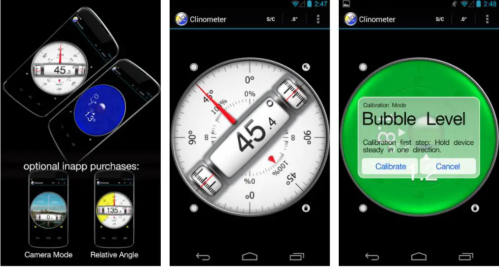
With all these modes of the Clinometer+ app, you’ll be able to simply calculate any measurement you want. The clinometer mode of Clinometer+ is an auto mode, it opens when you hold your device upright.
With the help of camera mode, you can measure any direction you want through manual activation. Not only absolute angels, with the help of the Clinometer+ app, you can also measure the relative angles between device positions, which is very helpful.
On Clinometer+, you’ll also get advanced two-way calibration on all sides. There are 5 different unit modes on the Clinometer+ app, you can set them according to your calculation.
All those units are- degree, percentage, rise, rise, run, 1V.H. The 1V:h unit is commonly used in engineering measurements. The dial rotation feature of the Clinometer+ app is also a very helpful feature that you can make use of.
On Clinometer+, you can smoothly rotate the dial and see which side of your phone represents. With the Clinometer+ app, you’ll also get a motion-sensitive lock feature, which will be very helpful in your measurement.
All the other inclinometer apps provide the common instant tap and hold mechanism, but only the Clinometer+ app provides you the power of the motion-sensitive lock.
When you activate this motion lock feature, your device waits for the final take for 2 seconds and efficiently locks between 0.1′ to 1.0′. This motion-sensitive lock feature can be very useful in degree measurement.
Clinometer+ also provides you the feature of adjustable auto-lock, which prevents your device from sleep mode. You can also make use of the full-screen mode while measuring, which will prevent you from various erroneous inputs.
You can also switch between colors by simply pressing S/C. Among all the inclinometer apps, I count this app as the best. So, download the Clinometer+ app and measure angles easily.
Features:-
- Slope finder, Bubble level, inclinometer
- Clinometer mode, camera mode
- 5 different unit modes
- Dial rotation, motion-sensitive lock, adjustable auto-lock
- Full-screen mode
- Different color schemes
Devices:- Android, IOS
Ratings:- 4.5/5 On Play Store, 4.3/5 On App Store
Download the App on Google Play Store
Download the App on Apple App Store
3. Smart Level
Another great inclinometer app is Smart Level. Smart Level is one of the best inclinometer apps that you can use. With the help of the Smart Level app, you can easily measure the inclination of any surface with your smartphone.
There are many helpful tools on the Smart Level app and you can use those smart features to efficiently measure any inclination.
On the Smart Level app, you’ll get a whole collection of top smart tools which will be very handy while measuring. With all the smart tools and features of Smart Level, it provides the most accurate measurement and this is the biggest highlight of this app.

All the features of Smart Level are very accurate and flexible, so, there is no question about the flexibility of this app.
On the Smart Level app, you’ll get features like surface level, spirit level, which are some of the most important inclinometer features. With the help of this bubble level feature, you’ll be able to see the inclination of any object by putting your device on that surface, which is pretty helpful.
There are 3 meters on the Smart Level app and with the help of all those meters, you’ll be able to get efficient measurements very fast.
It is very easy to use the Smart Level app, and the UI of Smart Level is also pretty simple, so there isn’t any problem regarding accessibility.
You can simply put your device on any plain surface or if you want you can also make use of the bar meter horizontal and vertical usages. Before measuring the angles on the Smart Level app, you have to set it as zero to get the right reading.
On the Smart Level app, you can also customize your app’s size, background, color combination, themes, etc. To help you with better reference, Smart Level also provides you with many units meters by which you’ll be able to see data in various units.
On Smart Level, you’ll get units like- degree, percent, radiant, etc. which will be very helpful for you. With all the features, you’ll be able to get data fast and accurately, so download the Smart Level app.
Features:-
- Surface level/Bubble level
- Spirit level
- Zero calibration
- Tilt units
- Lock screen
- Material design
- Pro Version
- Ruler, Protractor, thread pitch
Devices: Android
Ratings: 4.5/5 On the Play Store
Download the App on Google Play Store
4. Clinometer
The next name on our list is Clinometer. Clinometer is another great app that I’ll suggest you use. I’m adding the Clinometer app to my list because of its features.
Clinometer is a fully feature-packed app and with the help of this app, measuring angles will become easy. There are lots of professional tools and features on the Clinometer app and by using those, you’ll be able to get fast and efficient results.
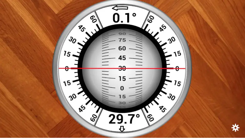
With the help of the Clinometer app, you’ll be able to measure any slope or angle very easily. The motion range of the Clinometer is 90′, so you can place your device on any side you want.
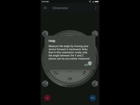
By using the toolbar menu, you can also adjust the precision up to 3 decimal places, which is a very advanced feature. On the left of the Clinometer app, you’ll get a touch hamburger button, which will help you to navigate through the menu.
You’ll also get the full user manual on the Clinometer app, which will help you to understand all the sensors and use those seamlessly. Private policies are also available with this app.
There are various features on the Clinometer app and you can easily use those features to measure any angle. You’ll get features like – clinometer, bubble level, laser level, etc. which are very advanced. All these features will be very helpful while measuring precise angles or inclinations.
On the Clinometer app, you’ll also get the feature of a compass, which is very helpful. This compass feature isn’t like a normal compass, this compass contains light and magnetic field computation features. This compass feature is one of the most attractive features of the Clinometer app.
Clinometer allows you to all the data in different units which helps you to understand the context in different forms. With the help of the Clinometer app, you can also measure all the slopes and angles which are not parallel to the ground.
Clinometer provides you with the relative angle mode, which helps you to do that. With the laser level, you’ll be able to measure the angles with your device’s camera, which is very useful. So, download the Clinometer app and get all these features.
Features:-
- Precise angle or inclination measurement
- Clinometer, bubble level, laser level, protractor
- Various unit systems
- Relative angle mode
- Measure through camera
- To-do list
- Capture images with measured values
Devices: Android
Ratings:- 4.8/5 On Play Store
Download the App on Google Play Store
5. Bubble Level
Bubble Level is our next app. Bubble Level is another great app that you can use to measure angles. This app is very popular and it has 5 million downloads on the Play Store. You can use this app to measure any slope or angle.
This app is also known as Spirit Level. Bubble Level uses an accelerometer sensor to analyze any object and measure, that’s why it provides accurate data.
The UI of this app is very simple which makes this app easy to use. There are various bubble-level features on this app and by using those features you’ll be able to measure all the angles and inclination.
Bubble Level is this popular because it provides accurate data, which attracts a lot of people. The design of the Bubble Level app is very stylish and it’s one of the easy-to-use apps.
With the help of the Bubble Level app, you’ll be able to measure vertical and horizontal water levels and you’ll also get an indicator for this, which is very beneficial. This water level indicator is a very advanced feature and you’ll get lots of benefits from it in real-life usage.
Bubble Level also provides you the feature of a ruler which will help you to see the dimension length. To help you more, Bubble Level provides zero level with audible indication.
There are 3 different display modes on the Bubble Level app and you can choose according to references. You can see all the measurement details in various units, which gonna help you a lot. The only reason I’m adding this app is all the features it provides.
You’ll get all the professional clinometer features on the Bubble Level app that you need to measure or see inclination. On the Bubble Level app, you’ll also get the hold function which will help you in angle measurement and calculation.
There is a smart feature on the Bubble Level app which keeps the screen active while using the app. You can use the Bubble Level app in 15 different languages which breaks all the language barriers.
All these professional features make this app one of the best inclinometer apps. Angle measurement becomes easy with the help of the Bubble Level app. So, download the Bubble Level app and get all the professional features.
Features:-
- Accurate measurement
- Easy-to-use
- Stylish Design
- Zero level with audible indication
- 3 different display modes
- Support 15+ languages
- Pro tools and features
- Always active display
- Lock icon while measuring
- Ruler feature
- Water level indicator
Devices: Android
Ratings: 4.6/5 On the Play Store
Download the App on Google Play Store
6. TiltMeter
TiltMeter is a professional-grade inclinometer app and it’s also considered one of the best inclinometer apps for IOS. This app contains various pro-angle measurement tools which will provide you with fast and accurate results in seconds.
I have to say that TiltMeter is one of the most professional apps that I’ve used. All the features of TiltMeter are very practical and you’ll feel this in real-life usage.
You can use the TiltMeter app for various purposes as it contains many useful features. You can use TiltMeter to measure angles of elevation, slope, or even inclination.
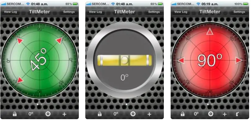
You can also make use of the TiltMeter app for picture alignment, which will be very helpful. With the help of the TiltMeter app, you can also measure the “look angle” of a satellite antenna, which is a very advanced feature.
While measurement, you’ll be also able to measure the slope angle of a chain with the advanced features of the TiltMeter app.
Not only these measurements, on the TiltMeter app, you can also perform root pitch calculation and angle calculation, which is a very advanced form of calculation. But there are some drawbacks to the free version of TiltMeter as well.
The free version of TiltMeter contains lots of ads and calibration is not saved on this version, so you have to set it every single time. With the pro version of the TiltMeter app, you’ll get a bubble level feature which is very helpful.
Not only bubble level, on the pro version, you’ll also get other features that will help you to calculate the angles more efficiently. The pro version contains features like the motion-sensitive lock, reference angle, logging measurement, sound feedback, calibration mode, etc.
You’ll also get the support of different precision modes. All these pro features are very much flexible and you’ll get the results in real-life usage. To get more screen space, you can also turn your app to full-screen mode.
The best part of the TiltMeter app is that it allows you to fully customize your app UI. On the TiltMeter app, you’ll get 8 different backgrounds and you can choose any to apply, and you’ll also get various color combinations.
TiltMeter disables your phone’s auto-sleep mode for your convenience, so your device would never fall asleep while using this app.
TiltMeter also supports retina display which is very helpful for many people out there. For accurate angle measurement, get the TiltMeter app.
Features:-
- Measure angle angles of elevation, slope, and inclination
- Measure the “look angle” of a satellite antenna towards a satellite
- The measure slope angle of a tape during distance measurement
- Bubble level, motion-sensitive lock, reference angle
- Logging measurements, sound feedbacks, calibration mode
- Different precision modes
- Full-screen mode, sleep mode disabled
- 8 different backgrounds
- Smart UI
Devices: IOS
Ratings:- 3.7/5 On App Store
Download App on Apple App Store
7. Simple Inclinometer
Simple Inclinometer is one of the best inclinometer apps that I know. Simple Inclinometer is considered one of the best slope finders, bubble level, and apps that you can use on your phone.
Simple Inclinometer uses all the slides of your device’s camera and provides you with unique measurements. With the Simple Inclinometer app, you’ll get a motion-sensitive lock feature, which will be very helpful in your measurement.
All the other apps provide the common instant tap and hold feature, but only the Simple Inclinometer app provides you the power of the motion-sensitive lock.
When you activate this motion lock feature, your device waits for the final take for a few seconds and efficiently locks degrees. This motion-sensitive lock feature can be very useful in degree measurement.
Simple Inclinometer also provides you the feature of adjustable auto-lock, which prevents your device from sleep mode. You can also make use of the full-screen mode while measuring, which will prevent you from distractions.
This app is very handy and flexible too, so it would be very helpful for all the users out there. This laser pointer uses built-in sensors and the device’s camera to determine the vertical and horizontal levels and to provide you with the correct measurement.
To make use of these features, you have to place your device on any surface and you can easily measure the angles. By using all these clinometer features, you can determine the angle of inclination.
On the Simple Inclinometer app, you can see all the data in various units, like- degree, percentage, rise, etc. Get the Simple Inclinometer app and ease down angle calculation.
Features:-
- Easy to use
- Clinometer, bubble level, laser level, protractor
- Various unit systems
- Relative angle mode
Devices: Android
Ratings: 4.7/5 On the Play Store
Download the App on Google Play Store
8. Rotating Sphere Inclinometer
The last name on our list is Rotating Sphere Inclinometer. With the help of the Rotating Sphere Inclinometer app, you can easily measure the inclination of any surface with your smartphone.
There are many helpful tools on the Rotating Sphere Inclinometer app and you can use those smart features to efficiently measure any inclination.
On the Rotating Sphere Inclinometer app, you’ll get a collection of top smart tools which will be very helpful while measuring.
With all the smart tools and features of the Rotating Sphere Inclinometer, you’ll get the most accurate measurement and this is the biggest highlight of this app. All the features of the Rotating Sphere Inclinometer are very accurate and flexible.
While measurement, you’ll be also able to measure the slope angle of a chain with the advanced features of the Rotating Sphere Inclinometer app.
Not only these measurements, on the Rotating Sphere Inclinometer app, you can also perform pitch calculation and angle calculation, which is a very advanced form of calculation. So, download Rotating Sphere Inclinometer and measure angles with ease.
Features:-
- Accurate clinometer
- Digital and analog indicators
- See data in different units
- Lock orientation
- Logging measurements, sound feedbacks, calibration mode
- Different precision modes
Devices: Android
Ratings: 4.5/5 On the Play Store
Download the App on Google Play Store
Conclusion
So, guys, this was the list of the best 8 inclinometer apps that you can make use of for angle measurement. All these apps are very much accurate and you’ll also get various advanced features with these apps.
You don’t need a physical inclinometer anymore; all these apps will efficiently do the job for you. So, try these apps and let us know in the comment section.