


Altimeter apps help trekkers and hikers find the exact altitude they are at the trekking time. Several tools are available to help you measure the altitude.
Still, they are quite costly, so it is better to use several altimeter apps that can be used on your Android and iOS devices and are completely cost-free.
These applications help you to keep track of your position all the time, and some of these applications have the features of a GPS tracker and compass installed in them, which makes it easier for the users to use these applications.
Use of Altimeter Apps
These altimeter apps measure the altitude above a certain reference point. There are several factors on which altimeter applications depend to measure altitude. These factors include barometric pressure, radar, and LiDAR.
Every factor has advantages and disadvantages, as barometric altimeters are cheap and easily installed. Still, they do not provide the exact altitude when air temperature and moisture levels change.
The altimeter apps that depend on radar and LiDar mostly provide exact altitudes as they determine the altitude and topography from the ground leading to accuracy in the results.
These applications are based on electromagnetic waves. But the users of these applications require a special license, and these applications should also comply with the FCC guidelines.
GPS altimeter applications receive signals from four or more satellites, and with the help of these signals, they determine the altitude.
The benefits of using GPS altimeter apps are that they are easy to use, implement, and use advanced technology.
Still, the biggest loophole is that these applications are expensive and do not provide the most accurate results.
Types of Altimeter Applications
There are different types of altimeter apps that have different and unique features. First is the digital altimeter; this altimeter does not have any dial and has a digital display.
These are used in modern aircraft and are very useful for pilots as they provide all the information on a single screen.
The next is the Analog Drum Pointer Altimeter. This altimeter is similar to automobile odometers as it has a single pointer and a two-way drum that has an increasing number. Usually, the pointer range is – to 99 ft, and the drum will display hundreds and thousands of feet.
Another type of altimeter is the Analog three-pointer altimeter. The features of this altimeter are that it has three-pointers on a circular dial.
Every pointer displays different altitudes as one pointer displays hundreds of feet, the other thousands of feet, and the last pointer displays ten thousand feet increments.
The last type of altimeter is the Encoding Altimeter. This altimeter is a bit difficult to use as it converts the altitude into the Gilham Code; the Gilham Code is an 11-digit binary code.
The aircraft transponder sends this Gilham Code to the ground level, where they decode the Gilham code to know the exact altitude.
The several altimeter apps that can be used on Android and iOS devices are as follows
Best Altimeter Apps – Our Top Pick👌👌
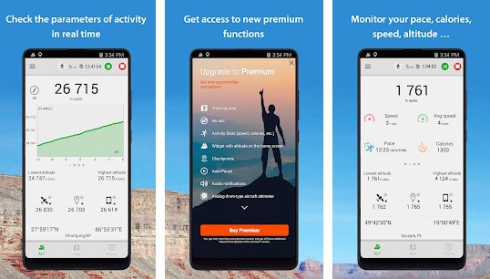
1. Compass
It is an application that provides accurate elevation and altitude measurements to users. It also shows the geographical direction.
Other features of this application are that it has a simple interface and works on both Android and iOS devices. Beginners also use the application comfortably as the application’s working is quite simple.
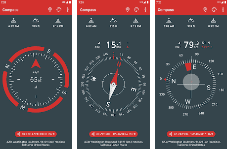
The other unique feature of this application is that it provides the sunrise and sunset time of your current location, and it can also provide other additional information about your current location. It also shows results in offline mode.
However, despite all these benefits, people sometimes do not prefer to use this application because it displays too many customized ads when connected to the internet, which becomes frustrating as it hampers their task.
People who want to use this application can download it from the Play Store.
Download the App on Google Play Store
2. GPS Tools
Along with measuring the elevation and altitude, this application is useful for navigation, compass, and weather forecasting.
Since the application can be used for so many purposes, it is a perfect application for anyone who fancies a good trekking experience or is indulged in adventures and outdoor activities.
People who are traveling can use this application to find and locate their area. Even if people are in areas without internet, they can also use this application, as it works offline.
But this application is not of much use to people in topographic areas as the application provides no access to topographic maps.
The interface of the application is quite advanced, so the users get highly accurate and precise results. Also, people who do not have good quality mobiles can use this application as it is battery efficient. It measures altitude from the sea level.
People with little technical knowledge also find this application quite easy because it displays the measurements on a single screen, making it simple for the users to understand.

Download the App on Google Play Store
Download the App from Apple App Store
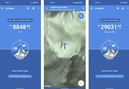
3. Altimeter Professional
Altimeter Professional is another amazing application that helps measure altitude and elevation from the sea level.
It does the same using both GPS and barometric sensors to ensure 100% accuracy in the measurements. Additionally, it provides weather forecasting and navigation to the users.
Besides that, you can even maintain detailed records of your locations and heights during your treks so that you may relive them moments later. Also, the flexibility is great.
The application provides altitude and elevation measurements in meters and feet, so it becomes quite easy for the users to understand the measurements.
Moreover, it has GPS and location-sharing features, so you can remain connected with your group, even if you go too fast or are left far behind. However, you can only use it on Android devices.

Download the App on Google Play Store
Download the App on Apple App Store
4. Barometer & Altimeter Pro
This is not just an application to measure altitude and elevation but also helps measure temperature and humidity levels.
People can also know details of the current weather conditions using this application. The use of this application is simple and easy. The application provides measurements by using the sea levels.
This application is the most trusted application by users as it provides the most accurate results in no time. Although a simple interface is useful for the users, sometimes it becomes a bane.
Due to the simple interface, the application does not support advanced technology, and that’s where it becomes a little restrictive.
Download the App on Google Play Store
5. Altimeter and Altimeter Widget
Another great application to track your altitude, elevation, and location with accurate measurements is the Altimeter and Altimeter Widget app.
It uses an inbuilt barometric sensor and a GPS to ensure accuracy in its data.
Besides that, it has advanced features and functionalities like a widget option on the home screen, taking snapshots, and using the application even in offline mode.
However, the ads can become irritating, also because they make the processing slow. Moreover, it’s built only for Android users.
Download the App on Google Play Store
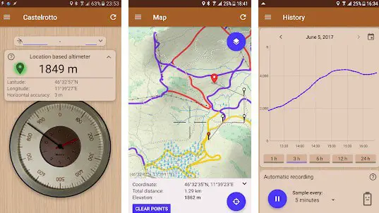
6. My Elevation
My Elevation is another amazing application to help you find altitude and elevation measurements above sea level.
Additionally, it has a GPS tracker to help find and share your location so that you’re never lost or separated from your group.
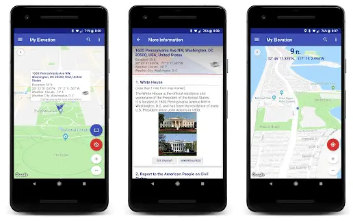
Additionally, the application has a weather forecasting feature using which you can have precise information about the weather during your trek and plan it accordingly for a better experience.
However, while it has such amazing features, a loophole is that it doesn’t work well in the offline mode and will entirely give up when you lose the cell networks.
Download the App on Google Play Store
7. Altimeter GPS
The application uses GPS satellites to provide users with altitude, location, and elevation information.
Hikers and trekkers find this application very simple and useful as the results are quick and the information provided is simple to read.
The major advantage of this application is that this application can work both in online and offline mode. Also, it provides measurements in meters and feet according to the users’ choice.
The unique feature of this application is that the information it provides is in the form of charts that are easily comparable and allow the users to take snapshots of their location.
The results of this application are highly précised. But there are glitches in this application often because people do not find it comfortable to use the application.
Download the App on Google Play Store
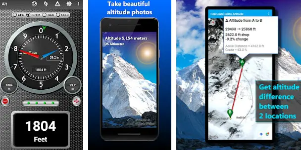
8. DS Barometer
This application has a simple interface and is stable and secure to use. It uses sensors and GPS to provide altitude and elevation measurements.
The application works in online mode only and can provide your location history also while using the internet.
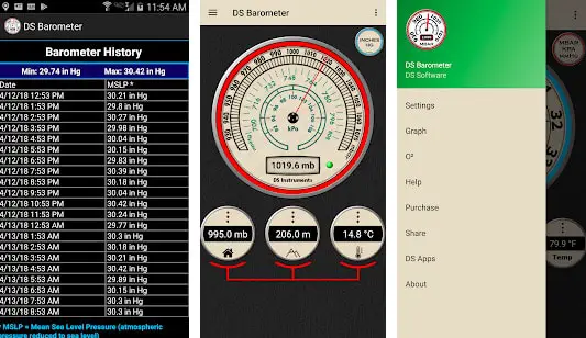
You can track your location easily with the help of this application in real time. Also, the usage of the application is quite simple.
It is a type of radar and LiDAR altimeter. The application shows the altitude and elevation measurements in both meters and feet.
However, it displays too many ads while using the free version. So, the users prefer to take the paid version of the application.
Download the App on Google Play Store
9. Altimeter Pro
It is one of those applications that provide the most precise results and gives measurements based on sea level.
It uses the GPS of your devices to provide the measurements. It has a simple interface and is quite simple to use, and it provides readings that are easy to read.
This application works well in both online and offline modes. It can also provide information about navigation maps to the users. It can provide you with precise location information in remote areas also.
However, using the application can drain the battery of your phone very quickly. So, it will be a wise option to take your power bank along.
Download the App on Google Play Store
10. My Altitude
This application is useful on iOS devices because it may not work well on Android devices. It can help you know the altitude and elevation measurements easily.
The application uses the sensors and GPS of your device; since the GPS and sensors of iOS devices are powerful, the results are quite accurate and precise.
Even if your device does not have advanced sensors, the application also provides accurate results quickly.
This application works in online mode only, and it also allows users to take pictures while using the application.
Download the App on Google Play Store
Download the App from Apple App Store
11. Accurate Altimeter
The application uses satellite signals to provide measurements of altitude to the users. It provides accurate results to the users even when in offline mode.
This application also provides altitude measurement by using the pressure sensor of your device.
The results provided by using this mode are also quick and accurate. It also areas on your elevation maps; thus, an application can be used in remote areas.
The other features of this application are that it is easy to use and also provides altitude history to the users.
But the loopholes of this application are that if the device does not have a good internet connection, then the application can provide misleading and inaccurate altitude measurements.
Also, the users face the problem of too many ads while using this application.

Download the App on Google Play Store
12. Smart Altimeter
The application works both in online and offline modes and provides measurements in meters and feet.
The results of this application are quite precise. It is a perfect application for trekkers and hikers on their journey.
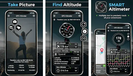
The additional features of this application are that it allows the users to take snapshots while using it, and the users can also record their trekking history with the help of this application.
The application provides information to the users through easily comparable charts. It measures the altitude from the ground level.
It also provides the option of weather forecasting and a smart compass to the users. These amazing features of this application improve the users’ experience while trekking.
Download the App on Google Play Store
14. Altimeter Offline
This is the most suitable for travelers going to places with low or no internet connection, as this application also works well in offline mode.
The application also displays the geographical coordinates of your location. There are chances when the users do not get highly-precise measurements, but it is decent enough to use.
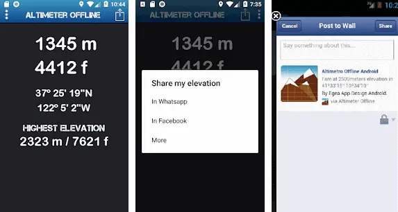
The application has an inbuilt tracker that makes it easier for the users to track their location while traveling. The application can get the altitude and elevation everywhere, such as trekking, hiking, cross-country skiing, and climbing mountain peaks.
The interface of this application is quite simple, so if you are looking for an advanced interface, then this application is of no use to you. The application works well both on Android and iOS devices.
It has an amazing feature that the users can share their location as well as their experience on social media with the help of this application.
The application is also user-friendly as it shuts down the GPS tracker as soon as it is closed so that excess battery is not drained because of the application.
Download the App on Google Play Store
While exploring the Best Altimeter Apps To Get Info About Your Current Position, I found an awesome video on “If Earth Rotated at the Speed of Light, There’d Be No Time,” worth watching.🤩🤩👌

15. Commander Compass Go
This is a powerful application and works in both online and offline modes. The application uses the GPS tracker of your device to provide the altitude and elevation measurements of your current location.
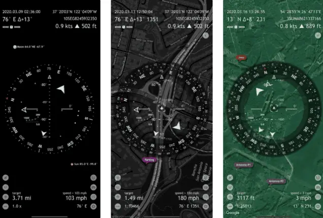
The application also has the features of a speedometer, gyrocompass, GPS receiver, and several other features.
The unique features of this application are that it can track multiple locations concurrently and keep a record of the locations tracked by the users. The users can also measure the distance and the angle they traveled.
Along with the altitude and elevation measurements, the application can also measure the position of the sun, moon, and stars. The application is quite advanced as it uses both calibration and compass methods for measurement.
For their comfort and convenience, the users can copy and paste links from this application and then search for them on the internet using different formats.
Download the App from Apple App Store
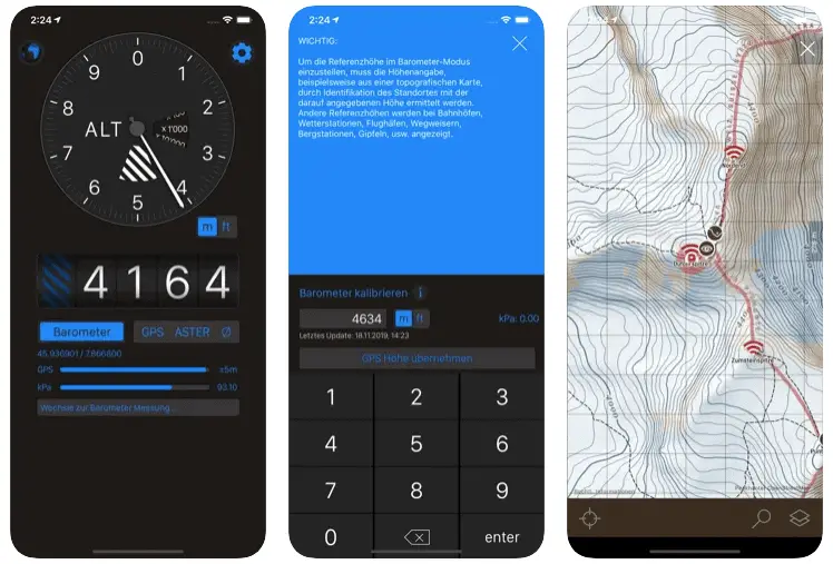
17. Altimeter by Pixel Prose SARL
This application will help you get accurate altitude measurements of your current location. The application will use the GPS of your device and provide you with altitude and elevation measurements.
Even when the users are out of range and do not have an internet connection, the application will also provide accurate altitude measurements.
According to their choice, the users can select the option of GPS or barometric in the application to get the altitude measurements.
The unique feature of this application is that the user can submit the name and address of the location they want to know the altitudes. The application has an advanced and attractive interface.
Download the App on Google Play Store
18. Altimeter +
Altimeter + is another application suitable for people who love trekking and skiing. The application helps people to know their exact location with the help of GPS.
It measures the altitude by using both GPS signals and barometric signals. Also, the users can keep a complete record of their trekking.
The application also helps you know the history of your current location.
The altitude and elevation measurements done by this application are highly-precise and accurate.
The application also shows maps to the users that have full information about the peaks. The users can also do an average calculation of altitudes with the help of this application.
The other features of this application include that when the user measures the altitude using barometric measurements, the measurements can be shown in both imperial and metric units according to the user’s choice.
The application works well in online and offline modes and provides accurate results. It works only on iOS devices.
Download the App from Apple App Store
✅FAQ’s
Can I use my phone as an altimeter?
Yes, many modern smartphones have built-in barometers, allowing them to function as altimeters.
Is there a free altimeter app?
Yes, many free altimeter apps are available for both iOS and Android devices.
here’s a table that lists some of the best free altimeter apps for Android:-
| App Name | Rating | Number of Downloads | Features |
|---|---|---|---|
| Altimeter | 4.6 | 1,000,000+ | Accurate altitude readings, GPS coordinates, barometric pressure, weather conditions |
| My Altitude | 4.4 | 500,000+ | Altitude tracking, GPS coordinates, sunrise/sunset times, compass, weather information |
| Barometer & Altimeter | 4.3 | 100,000+ | Barometric pressure readings, altitude tracking, temperature, wind speed/direction |
| GPS Altitude | 4.1 | 100,000+ | GPS-based altitude tracking, digital compass, pitch/roll angles |
| Altimeter & Barometer | 3.8 | 10,000+ | Altitude tracking, barometric pressure readings, temperature, wind speed/direction |
What is the best free altimeter app for iPhone?
Some popular free altimeter apps for iPhone include “Altimeter+” and “My Altitude”.
here’s a table of some of the best free altimeter apps for iPhone:-
| App Name | App Store Rating | Features |
|---|---|---|
| Altimeter GPS | 4.8 | GPS altitude, barometric altitude, map view, elevation graph |
| My Altitude | 4.7 | GPS altitude, barometric altitude, camera feature, elevation data |
| Barometer & Altimeter | 4.6 | Barometric altitude, weather forecast, customizable settings |
| altiVario | 4.4 | GPS altitude, barometric altitude, variometer, customizable settings |
| Altimeter+ | 4.3 | GPS altitude, barometric altitude, compass, map view |
| Altimeter – GPS+ | 4.2 | GPS altitude, barometric altitude, map view, elevation data |
| Altimeter GPS+ | 4.1 | GPS altitude, barometric altitude, map view, elevation chart |
| Altimeter & Compass+ | 4.0 | GPS altitude, barometric altitude, compass, map view |
Is there an app for knowing elevation?
Yes, many apps are available for iOS and Android devices that can show your current elevation, such as “My Altitude” and “Elevation Tracker”.
Does iPhone have altitude sensor?
Yes, many iPhone models have a built-in barometer that can function as an altitude sensor.
Do iPhones have built in altimeter?
Yes, many modern iPhones have a built-in barometer which allows them to function as an altimeter.
How accurate is a smartphone altimeter?
The accuracy of a smartphone altimeter can vary depending on the device and the environment. In general, they are accurate to within a few meters.
here’s a table on the accuracy of smartphone altimeters:-
| Altitude Measurement | Accuracy |
|---|---|
| GPS-based altitude | Within 10 meters (33 feet) |
| Barometric-based altitude | Within 1 meter (3.3 feet) |
| Combination of GPS and barometric-based altitude | Within 1 meter (3.3 feet) |
| Network-based altitude | Within 50 meters (164 feet) |
| Altitude Range | Accuracy |
|---|---|
| 0-1,000 feet | +/- 50 feet |
| 1,000-5,000 feet | +/- 100 feet |
| 5,000-10,000 feet | +/- 200 feet |
| Above 10,000 feet | +/- 500 feet |
| Altitude Accuracy Range | Description |
|---|---|
| ±1 meter (3 feet) | Best case scenario |
| ±5 meters (16 feet) | Typical accuracy in ideal conditions |
| ±10 meters (33 feet) | Typical accuracy in less than ideal conditions (e.g. cloudy or indoors) |
| >±10 meters | Potential accuracy issues due to various factors (e.g. atmospheric pressure changes, software glitches, hardware limitations) |
Does Waze show elevation?
No, Waze does not currently show elevation information.
Does Google Maps have an altimeter?
No, Google Maps does not have a built-in altimeter feature.
How accurate is iPhone altimeter?
The accuracy of the iPhone altimeter can vary depending on the device and the environment. In general, it is accurate to within a few meters.
here’s a table on the accuracy of iPhone altimeters:-
| iPhone Model | Altitude Accuracy |
|---|---|
| iPhone 6 | +/- 10 meters |
| iPhone 7 | +/- 10 meters |
| iPhone 8 | +/- 10 meters |
| iPhone X | +/- 10 meters |
| iPhone XS | +/- 10 meters |
| iPhone XR | +/- 10 meters |
| iPhone 11 | +/- 5 meters |
| iPhone 12 | +/- 5 meters |
| iPhone 13 | +/- 5 meters |
How do I see floors climbed on my iPhone?
You can see your floors climbed on the iPhone by opening the “Health” app and navigating to the “Steps” tab. Your floors climbed will be displayed below your step count.
What is the most accurate altimeter?
The most accurate altimeters are typically professional-grade devices used by pilots and mountaineers.
here is a table of some of the most accurate altimeters available on the market:-
| Altimeter | Accuracy | Features | Price Range |
|---|---|---|---|
| Kestrel 5500 | ±3 ft | Measures altitude, pressure, temperature, and more | $349 – $399 |
| Suunto Core | ±16 ft | Measures altitude, pressure, temperature, and has a compass and weather features | $199 – $299 |
| Garmin Foretrex 401 | ±50 ft | Measures altitude, has GPS and compass, and can track routes and waypoints | $199 – $249 |
| Casio Pro Trek PRW-3500 | ±50 ft | Measures altitude, has a compass, barometer, and thermometer, and is water-resistant | $200 – $350 |
| Brunton ADC Pro | ±50 ft | Measures altitude, pressure, temperature, wind speed and direction, and has a weather forecast function | $160 – $199 |
How do I get Google Maps to show elevation?
Currently, Google Maps does not have a built-in feature to show elevation.
What is the most accurate way to measure elevation?
The most accurate way to measure elevation is with a professional-grade altimeter or GPS device.
here’s a table outlining some of the most accurate ways to measure elevation:-
| Method | Description | Accuracy |
|---|---|---|
| Differential GPS | Uses satellites to measure the difference in height between two points | +/- 2 cm |
| Airborne Lidar | Uses lasers to measure the distance between the sensor and the ground | +/- 5 cm |
| Ground-based Lidar | Uses lasers to measure the distance between the sensor and the ground | +/- 5 cm |
| Total Station Surveying | Uses a surveying instrument to measure angles and distances between points | +/- 10 cm |
| Barometric Altimetry | Measures the atmospheric pressure to estimate elevation | +/- 10 cm |
| Satellite Radar Altimetry | Measures the time delay between radar pulses reflected off the Earth’s surface | +/- 10 cm |
| Photogrammetry | Uses aerial photographs to create 3D models and estimate elevation | +/- 15 cm |
| Topographic Maps | Uses contour lines and other features to estimate elevation | +/- 15 cm |
Does Apple have an altimeter app?
Apple does not have a built-in altimeter app, but many third-party altimeter apps are available on the App Store.
What is an Apple altimeter?
Apple altimeter is a feature on some iPhone models that uses a built-in barometer to measure altitude.
Does iPhone GPS work at altitude?
Yes, iPhone GPS can work at high altitudes. However, the accuracy of the GPS signal may be affected by the altitude and other environmental factors.
How do you measure elevation on a cell phone?
You can measure elevation on a cell phone by using a third-party altimeter app or a GPS app that displays elevation information.
How far off can an altimeter be?
The accuracy of an altimeter can vary depending on the device and the environment. In general, altimeters are accurate to within a few meters.
What is the difference between GPS altimeter and location altimeter?
A GPS altimeter uses GPS signals to determine altitude, while a location altimeter uses other methods such as barometric pressure or radar.
What map can show elevation?
Many maps can show elevation information, including topographic maps and satellite imagery.
How accurate is GPS for elevation?
The accuracy of GPS for elevation can vary depending on the device and the environment. In general, GPS is accurate to within a few meters.
Can a GPS be used as an altimeter?
Yes, a GPS can be used as an altimeter by the GPS signal to determine altitude.
Is Google Earth Pro still free?
No, Google Earth Pro is not free. However, a free version of Google Earth is available that includes many of the same features.
Does Apple maps show altitude?
No, Apple Maps does not currently show altitude information.
Is an Apple watch an altimeter?
Many Apple Watch models have a built-in barometer which allows them to function as an altimeter.
How do I calibrate my iPhone elevation?
You can calibrate your iPhone’s elevation by going to the Compass app and swiping left to access the level tool. From there, you can calibrate your iPhone’s altitude sensor.
Is there an app that tracks stairs climbed?
Yes, many fitness tracking apps such as “Fitbit” and “Google Fit” track stairs climbed as part of their activity tracking features.
What is the app that measures floors climbed?
The “Health” app on iPhone measures floors climbed and other fitness and health data.
How does my phone know when I go up stairs?
Your phone can detect when you go up stairs using its built-in accelerometer, which detects changes in motion and orientation.
Does altimeter show true altitude?
An altimeter measures pressure changes and calculates altitude based on those measurements. However, due to variations in atmospheric pressure, the altitude shown on an altimeter may not always be the same as true altitude.
Is altimeter and elevation the same?
An altimeter measures altitude, the height above a certain reference point. Elevation refers to the height above sea level.
What are the two types of altimeter?
There are two main types of altimeters: barometric altimeters, which measure atmospheric pressure to determine altitude, and radio altimeters, which use radar to measure distance from the ground.
How do you find elevation with GPS?
You can find elevation with GPS by using a GPS app that displays elevation information, such as “My Altitude” or “Elevation Tracker”.
Where is elevation settings in Google Earth?
To show elevation information in Google Earth, go to the “View” menu and select “Elevation Profile”. This will display a graph of elevation changes along your selected path.
Is there a free altimeter app?
Yes, Barometer & Altimeter Pro, DS Altimeter, Altimeter by Pixel Prose SARL, and Altimeter by EXA Tools, etc. are some amazing free altimeter applications you can try to effortlessly find accurate altitude and get the best out of your hiking and trekking experience.
What is a good altimeter app?
Compass, GPS Tools, Altimeter Professional, My Elevation, Altimeter Pro, etc., are great altimeter applications and can be immensely helpful in finding altitude.
You can even use these wonderful apps to find the compass, weather forecasting, navigation, and more.
Can I use my iPhone as an altimeter?
You can easily download and use altimeter applications like My Altitude, Altimeter GPS, Travel Altimeter & Elevation, GPS Tools, and Altimeter: Elevation & Compass to Use your iPhone as an altimeter.
What is the best free altimeter app for iPhone?
Using the built-in compass on your iPhone is the best way to find altitudes without much problem. It has a built-in elevation feature and measures the altitude effectively and accurately.
If you want to use a third-party application, you can try using the My Altitude application, which is available free of cost and can be used perfectly on an iPhone.
Does my phone have an altimeter?
Unfortunately, there isn’t any altimeter application present on your phone by default. However, you can try some amazing third-party applications to check your altitude without hassle.
Most often than not, the accuracy of these applications doesn’t vary much as they always use the same method to calculate altitude, and you can rely on them.
How accurate is the iPhone elevation app?
Elevation tracker for iPhone this is elevation data provided by the GPS receiver of your iPhone, which is usually about 10 to 30 meters.
And it means the elevation displayed by the elevation tracker for iPhone is likely to be inaccurate by around 30 meters at any point, usually depending on your location and Internet connection.
How accurate is Google elevation?
According to a study on vertical accuracy of Google elevation records, the accuracy was 8.68 meters when the experts compared the recorded data from 18,000 geodetic control points in the United States.
Can Google maps show elevation?
You can instead use Google Earth pro to check out the elevation without much hassle. You must enter your address or location in the search bar for that.
You will see layers in the upper right corner of the map, choose terrain in the popup menu, and then tap “X” to close the menu. Now, you can see the elevation in feet simply by zooming in, as there will appear a fainty along the contour lines on the screen.
Is Google Earth Pro accurate?
It is not cent percent accurate but is better than most third-party elevation applications. According to a study on the accuracy of Google Earth Pro, it has presented an average error of 1.45% on-road, 1.61% off-road, and 1.73% for curved paths, respectively.
How accurate are Google Maps property lines?
Property lines on Google Maps are inaccurate, and you shouldn’t rely on them, especially for factual information. Google Maps are only designed to provide a basic idea of where the property lines exist.
How do I find elevation on Android?
You don’t have to ponder much, as there are so many amazing, simple, and easy-to-use altimeter applications you can download to find elevation on your Android device easily. Some decent names are Compass, GPS Tools, My Altitude, Altimeter Pro, Smart Altimeter, etc.
Final Words
So, these are the several altimeter apps that help you know the exact altitude and elevation measurements of your location quickly. The users can use these according to their needs and devices.
We hope this was helpful and you’ve downloaded the application you like best for your next trek. Happy Trekking!